You are here: Home > Network List > TA - USArray Transportable Network (new EarthScope stations) Stations List
> Station H31M Peel River, Yukon, CAN > Earthquake Result Viewer
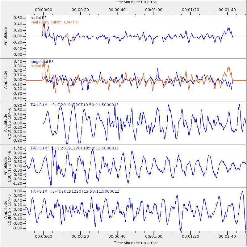
H31M Peel River, Yukon, CAN - Earthquake Result Viewer
*The percent match for this event was below the threshold and hence no stack was calculated.
| Earthquake location: |
Southeast Of Honshu, Japan |
| Earthquake latitude/longitude: |
32.9/142.8 |
| Earthquake time(UTC): |
2019/12/20 (354) 19:40:52 GMT |
| Earthquake Depth: |
10 km |
| Earthquake Magnitude: |
5.3 Mww |
| Earthquake Catalog/Contributor: |
NEIC PDE/us |
|
| Network: |
TA USArray Transportable Network (new EarthScope stations) |
| Station: |
H31M Peel River, Yukon, CAN |
| Lat/Lon: |
65.81 N/134.34 W |
| Elevation: |
642 m |
|
| Distance: |
57.7 deg |
| Az: |
28.952 deg |
| Baz: |
278.688 deg |
| Ray Param: |
$rayparam |
*The percent match for this event was below the threshold and hence was not used in the summary stack. |
|
| Radial Match: |
50.5921 % |
| Radial Bump: |
400 |
| Transverse Match: |
55.689228 % |
| Transverse Bump: |
400 |
| SOD ConfigId: |
20358551 |
| Insert Time: |
2020-01-03 19:52:40.748 +0000 |
| GWidth: |
2.5 |
| Max Bumps: |
400 |
| Tol: |
0.001 |
|
Signal To Noise
| Channel | StoN | STA | LTA |
| TA:H31M: :BHZ:20191220T19:50:11.500001Z | 1.7785139 | 6.932021E-7 | 3.8976478E-7 |
| TA:H31M: :BHN:20191220T19:50:11.500001Z | 1.0094529 | 2.7770827E-7 | 2.751077E-7 |
| TA:H31M: :BHE:20191220T19:50:11.500001Z | 0.65653306 | 3.447773E-7 | 5.2514844E-7 |
| Arrivals |
| Ps | |
| PpPs | |
| PsPs/PpSs | |


