
BNI Bardonecchia, Italy - Earthquake Result Viewer
| ||||||||||||||||||
| ||||||||||||||||||
| ||||||||||||||||||
|
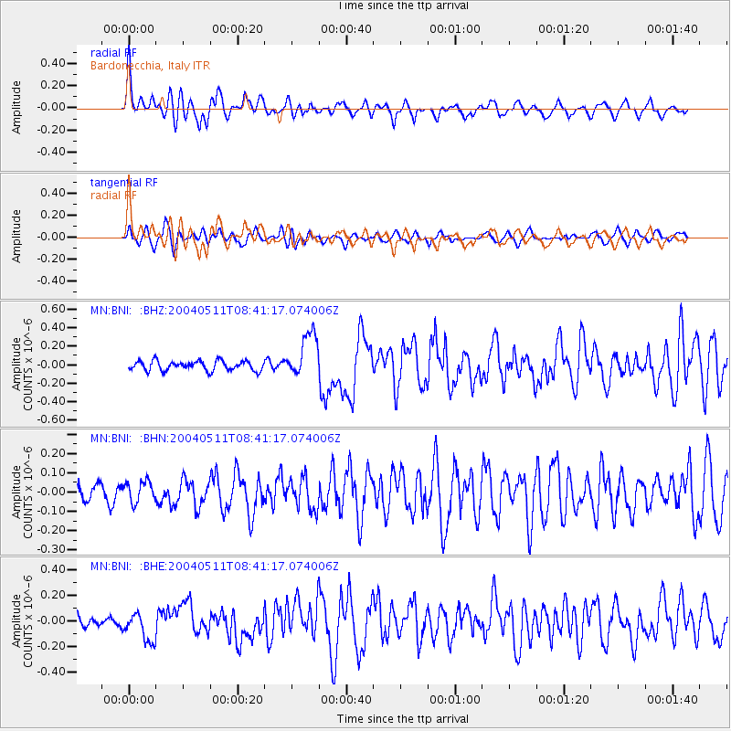
Signal To Noise
| Channel | StoN | STA | LTA |
| MN:BNI: :BHN:20040511T08:41:17.074006Z | 1.0935758 | 5.2950764E-8 | 4.841984E-8 |
| MN:BNI: :BHE:20040511T08:41:17.074006Z | 2.9036636 | 1.1907112E-7 | 4.10072E-8 |
| MN:BNI: :BHZ:20040511T08:41:17.074006Z | 4.700197 | 2.4678332E-7 | 5.2504884E-8 |
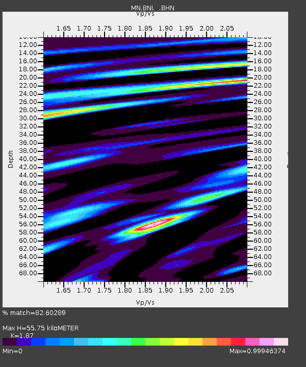
| Arrivals | |
| Ps | 7.7 SECOND |
| PpPs | 24 SECOND |
| PsPs/PpSs | 32 SECOND |

