You are here: Home > Network List > CN - Canadian National Seismograph Network Stations List
> Station INK INUVIK, NT > Earthquake Result Viewer
INK INUVIK, NT - Earthquake Result Viewer
*The percent match for this event was below the threshold and hence no stack was calculated.
| Earthquake location: |
W. Caroline Islands, Micronesia |
| Earthquake latitude/longitude: |
11.5/141.7 |
| Earthquake time(UTC): |
2019/12/23 (357) 06:33:40 GMT |
| Earthquake Depth: |
47 km |
| Earthquake Magnitude: |
5.8 Mww |
| Earthquake Catalog/Contributor: |
NEIC PDE/us |
|
| Network: |
CN Canadian National Seismograph Network |
| Station: |
INK INUVIK, NT |
| Lat/Lon: |
68.31 N/133.53 W |
| Elevation: |
44 m |
|
| Distance: |
77.4 deg |
| Az: |
22.292 deg |
| Baz: |
269.47 deg |
| Ray Param: |
$rayparam |
*The percent match for this event was below the threshold and hence was not used in the summary stack. |
|
| Radial Match: |
61.904564 % |
| Radial Bump: |
400 |
| Transverse Match: |
49.40398 % |
| Transverse Bump: |
400 |
| SOD ConfigId: |
20358551 |
| Insert Time: |
2020-01-06 06:45:31.913 +0000 |
| GWidth: |
2.5 |
| Max Bumps: |
400 |
| Tol: |
0.001 |
|
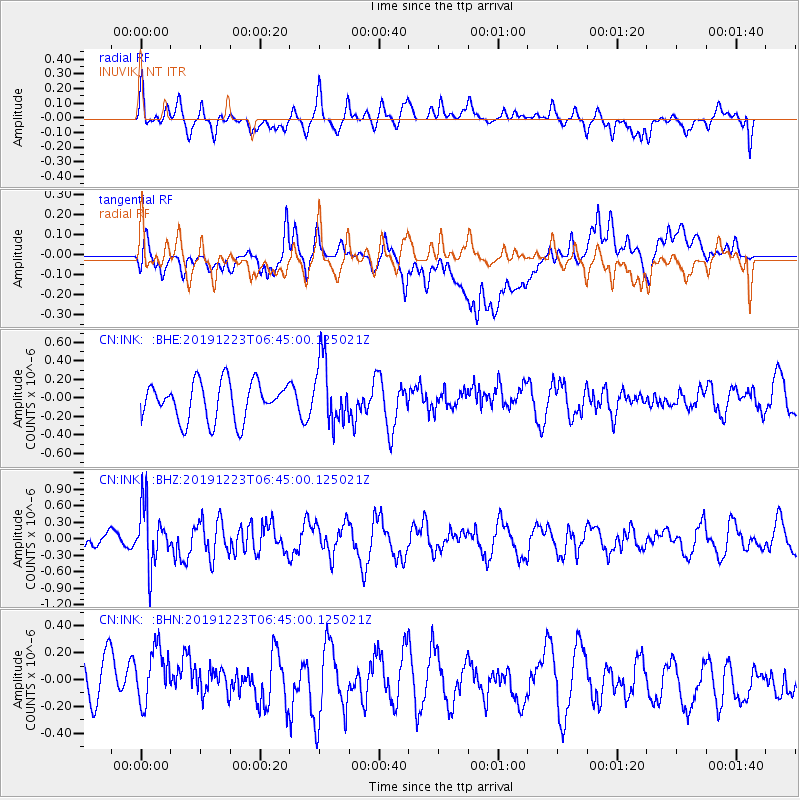
Signal To Noise
| Channel | StoN | STA | LTA |
| CN:INK: :BHZ:20191223T06:45:00.125021Z | 2.6030629 | 5.3789194E-7 | 2.0663809E-7 |
| CN:INK: :BHN:20191223T06:45:00.125021Z | 1.0684354 | 2.9499202E-7 | 2.7609718E-7 |
| CN:INK: :BHE:20191223T06:45:00.125021Z | 1.6605818 | 3.4031993E-7 | 2.0494016E-7 |
| Arrivals |
| Ps | |
| PpPs | |
| PsPs/PpSs | |


