You are here: Home > Network List > TA - USArray Transportable Network (new EarthScope stations) Stations List
> Station G31M Satah River, YT, CAN > Earthquake Result Viewer
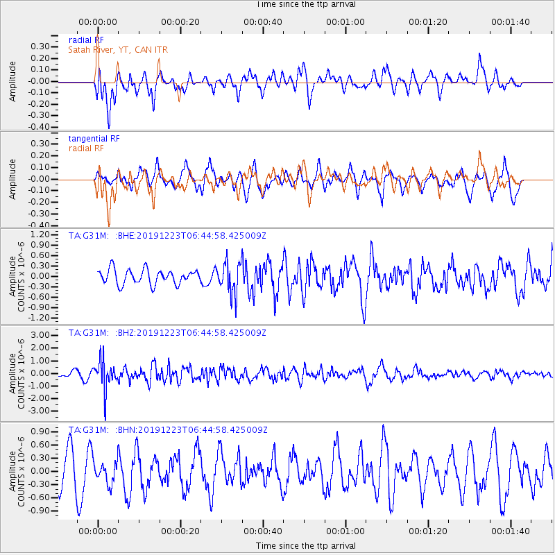
G31M Satah River, YT, CAN - Earthquake Result Viewer
*The percent match for this event was below the threshold and hence no stack was calculated.
| Earthquake location: |
W. Caroline Islands, Micronesia |
| Earthquake latitude/longitude: |
11.5/141.7 |
| Earthquake time(UTC): |
2019/12/23 (357) 06:33:40 GMT |
| Earthquake Depth: |
47 km |
| Earthquake Magnitude: |
5.8 Mww |
| Earthquake Catalog/Contributor: |
NEIC PDE/us |
|
| Network: |
TA USArray Transportable Network (new EarthScope stations) |
| Station: |
G31M Satah River, YT, CAN |
| Lat/Lon: |
66.92 N/134.27 W |
| Elevation: |
61 m |
|
| Distance: |
77.1 deg |
| Az: |
23.714 deg |
| Baz: |
269.095 deg |
| Ray Param: |
$rayparam |
*The percent match for this event was below the threshold and hence was not used in the summary stack. |
|
| Radial Match: |
63.987408 % |
| Radial Bump: |
400 |
| Transverse Match: |
48.15599 % |
| Transverse Bump: |
393 |
| SOD ConfigId: |
20358551 |
| Insert Time: |
2020-01-06 06:48:06.146 +0000 |
| GWidth: |
2.5 |
| Max Bumps: |
400 |
| Tol: |
0.001 |
|
Signal To Noise
| Channel | StoN | STA | LTA |
| TA:G31M: :BHZ:20191223T06:44:58.425009Z | 4.0179853 | 1.1151768E-6 | 2.7754626E-7 |
| TA:G31M: :BHN:20191223T06:44:58.425009Z | 0.8023415 | 2.443651E-7 | 3.0456494E-7 |
| TA:G31M: :BHE:20191223T06:44:58.425009Z | 2.160512 | 4.5420114E-7 | 2.1022846E-7 |
| Arrivals |
| Ps | |
| PpPs | |
| PsPs/PpSs | |


