You are here: Home > Network List > US - United States National Seismic Network Stations List
> Station EGMT Eagleton, Montana, USA > Earthquake Result Viewer
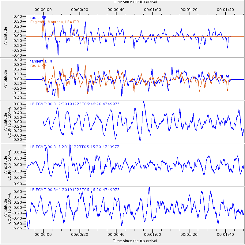
EGMT Eagleton, Montana, USA - Earthquake Result Viewer
*The percent match for this event was below the threshold and hence no stack was calculated.
| Earthquake location: |
W. Caroline Islands, Micronesia |
| Earthquake latitude/longitude: |
11.5/141.7 |
| Earthquake time(UTC): |
2019/12/23 (357) 06:33:40 GMT |
| Earthquake Depth: |
47 km |
| Earthquake Magnitude: |
5.8 Mww |
| Earthquake Catalog/Contributor: |
NEIC PDE/us |
|
| Network: |
US United States National Seismic Network |
| Station: |
EGMT Eagleton, Montana, USA |
| Lat/Lon: |
48.02 N/109.75 W |
| Elevation: |
1055 m |
|
| Distance: |
93.6 deg |
| Az: |
39.618 deg |
| Baz: |
291.412 deg |
| Ray Param: |
$rayparam |
*The percent match for this event was below the threshold and hence was not used in the summary stack. |
|
| Radial Match: |
54.782658 % |
| Radial Bump: |
400 |
| Transverse Match: |
56.972454 % |
| Transverse Bump: |
400 |
| SOD ConfigId: |
20358551 |
| Insert Time: |
2020-01-06 06:48:47.421 +0000 |
| GWidth: |
2.5 |
| Max Bumps: |
400 |
| Tol: |
0.001 |
|
Signal To Noise
| Channel | StoN | STA | LTA |
| US:EGMT:00:BHZ:20191223T06:46:20.474997Z | 2.6385303 | 4.6614963E-7 | 1.7667018E-7 |
| US:EGMT:00:BH1:20191223T06:46:20.474997Z | 0.7286046 | 1.8556086E-7 | 2.5467978E-7 |
| US:EGMT:00:BH2:20191223T06:46:20.474997Z | 1.0138059 | 3.1310063E-7 | 3.088369E-7 |
| Arrivals |
| Ps | |
| PpPs | |
| PsPs/PpSs | |


