BNI Bardonecchia, Italy - Earthquake Result Viewer
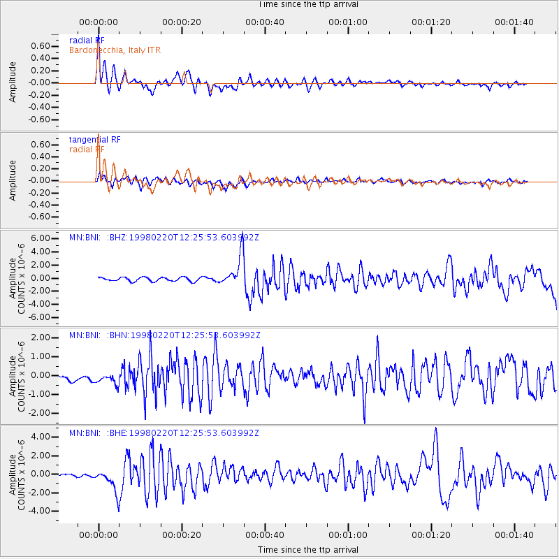
Earthquake location: Afghanistan-Tajikistan Bord Reg.
Earthquake latitude/longitude: 36.5/71.1
Earthquake time(UTC): 1998/02/20 (051) 12:18:06 GMT
Earthquake Depth: 236 km
Earthquake Magnitude: 5.8 MB, 5.7 MS, 6.4 UNKNOWN, 6.3 MW
Earthquake Catalog/Contributor: WHDF/NEIC
Network: MN MEDNET Project
Station: BNI Bardonecchia, Italy
Lat/Lon: 45.05 N/6.68 E
Elevation: 1395 m
Distance: 48.4 deg
Az: 301.206 deg
Baz: 76.537 deg
Ray Param: 0.068496466
Estimated Moho Depth: 10.0 km
Estimated Crust Vp/Vs: 1.71
Assumed Crust Vp: 6.416 km/s
Estimated Crust Vs: 3.763 km/s
Estimated Crust Poisson's Ratio: 0.24
Radial Match: 84.12047 %
Radial Bump: 400
Transverse Match: 71.91562 %
Transverse Bump: 400
SOD ConfigId: 6273
Insert Time: 2010-03-08 16:50:04.703 +0000
GWidth: 2.5
Max Bumps: 400
Tol: 0.001

Signal To Noise

ChannelStoNSTALTA
MN:BNI: :BHN:19980220T12:25:53.603992Z1.02838682.5289657E-72.459158E-7
MN:BNI: :BHE:19980220T12:25:53.603992Z6.111661.3796158E-62.2573504E-7
MN:BNI: :BHZ:19980220T12:25:53.603992Z8.3761852.5164034E-63.0042355E-7
Arrivals
Ps1.2 SECOND
PpPs4.0 SECOND
PsPs/PpSs5.1 SECOND