You are here: Home > Network List > IU - Global Seismograph Network (GSN - IRIS/USGS) Stations List
> Station PMG Port Moresby, New Guinea > Earthquake Result Viewer
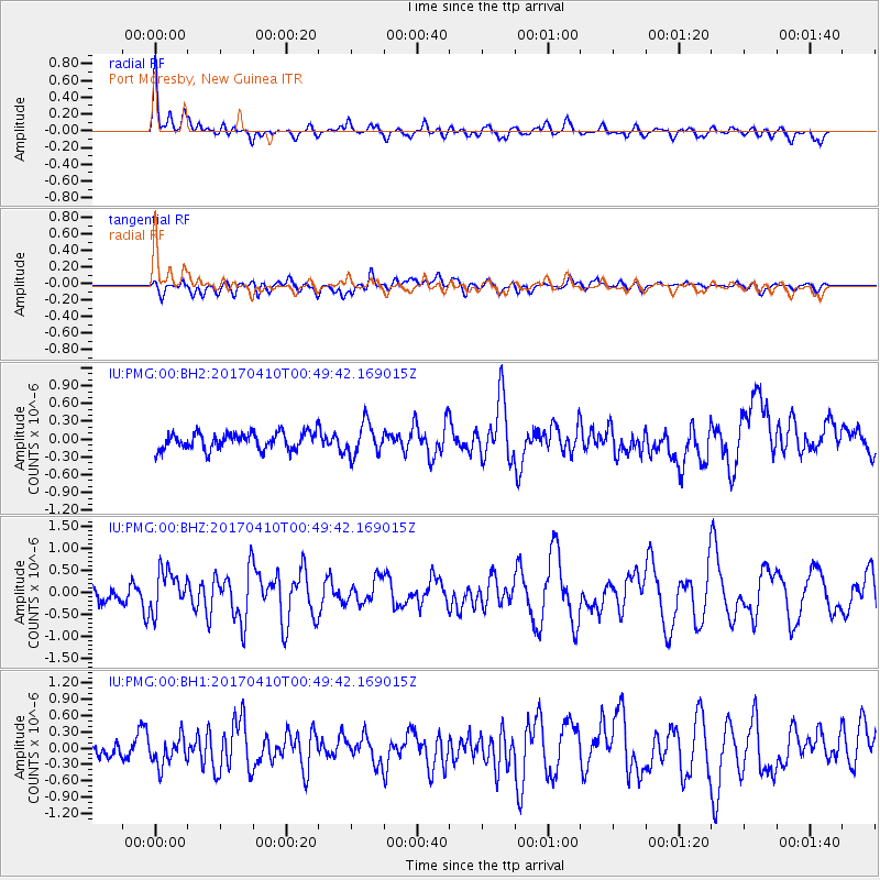
PMG Port Moresby, New Guinea - Earthquake Result Viewer
*The percent match for this event was below the threshold and hence no stack was calculated.
| Earthquake location: |
Philippine Islands Region |
| Earthquake latitude/longitude: |
13.0/125.4 |
| Earthquake time(UTC): |
2017/04/10 (100) 00:43:54 GMT |
| Earthquake Depth: |
8.2 km |
| Earthquake Magnitude: |
5.6 Mww |
| Earthquake Catalog/Contributor: |
NEIC PDE/us |
|
| Network: |
IU Global Seismograph Network (GSN - IRIS/USGS) |
| Station: |
PMG Port Moresby, New Guinea |
| Lat/Lon: |
9.40 S/147.16 E |
| Elevation: |
90 m |
|
| Distance: |
31.1 deg |
| Az: |
134.762 deg |
| Baz: |
315.468 deg |
| Ray Param: |
$rayparam |
*The percent match for this event was below the threshold and hence was not used in the summary stack. |
|
| Radial Match: |
79.759865 % |
| Radial Bump: |
400 |
| Transverse Match: |
47.950344 % |
| Transverse Bump: |
400 |
| SOD ConfigId: |
2028011 |
| Insert Time: |
2017-04-24 00:45:59.333 +0000 |
| GWidth: |
2.5 |
| Max Bumps: |
400 |
| Tol: |
0.001 |
|
Signal To Noise
| Channel | StoN | STA | LTA |
| IU:PMG:00:BHZ:20170410T00:49:42.169015Z | 2.582975 | 4.503243E-7 | 1.7434327E-7 |
| IU:PMG:00:BH1:20170410T00:49:42.169015Z | 2.3203783 | 2.6005003E-7 | 1.1207226E-7 |
| IU:PMG:00:BH2:20170410T00:49:42.169015Z | 1.8416772 | 2.6469988E-7 | 1.4372763E-7 |
| Arrivals |
| Ps | |
| PpPs | |
| PsPs/PpSs | |


