You are here: Home > Network List > US - United States National Seismic Network Stations List
> Station HAWA Hanford, Washington, USA > Earthquake Result Viewer
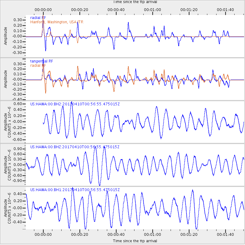
HAWA Hanford, Washington, USA - Earthquake Result Viewer
*The percent match for this event was below the threshold and hence no stack was calculated.
| Earthquake location: |
Philippine Islands Region |
| Earthquake latitude/longitude: |
13.0/125.4 |
| Earthquake time(UTC): |
2017/04/10 (100) 00:43:54 GMT |
| Earthquake Depth: |
8.2 km |
| Earthquake Magnitude: |
5.6 Mww |
| Earthquake Catalog/Contributor: |
NEIC PDE/us |
|
| Network: |
US United States National Seismic Network |
| Station: |
HAWA Hanford, Washington, USA |
| Lat/Lon: |
46.39 N/119.53 W |
| Elevation: |
364 m |
|
| Distance: |
97.2 deg |
| Az: |
39.174 deg |
| Baz: |
297.194 deg |
| Ray Param: |
$rayparam |
*The percent match for this event was below the threshold and hence was not used in the summary stack. |
|
| Radial Match: |
66.67896 % |
| Radial Bump: |
400 |
| Transverse Match: |
59.84367 % |
| Transverse Bump: |
400 |
| SOD ConfigId: |
2028011 |
| Insert Time: |
2017-04-24 00:46:33.762 +0000 |
| GWidth: |
2.5 |
| Max Bumps: |
400 |
| Tol: |
0.001 |
|
Signal To Noise
| Channel | StoN | STA | LTA |
| US:HAWA:00:BHZ:20170410T00:56:55.475015Z | 2.8312578 | 4.4903638E-7 | 1.5859962E-7 |
| US:HAWA:00:BH1:20170410T00:56:55.475015Z | 0.4828 | 8.9218844E-8 | 1.8479462E-7 |
| US:HAWA:00:BH2:20170410T00:56:55.475015Z | 1.0630407 | 3.2465158E-7 | 3.05399E-7 |
| Arrivals |
| Ps | |
| PpPs | |
| PsPs/PpSs | |


