You are here: Home > Network List > MN - MEDNET Project Stations List
> Station CEL Celeste, Italy > Earthquake Result Viewer
CEL Celeste, Italy - Earthquake Result Viewer

| Earthquake location: |
Taiwan Region |
| Earthquake latitude/longitude: |
24.1/122.6 |
| Earthquake time(UTC): |
2006/10/12 (285) 14:46:30 GMT |
| Earthquake Depth: |
44 km |
| Earthquake Magnitude: |
5.7 MB, 5.4 MS, 5.7 MW, 5.7 MW |
| Earthquake Catalog/Contributor: |
WHDF/NEIC |
|
| Network: |
MN MEDNET Project |
| Station: |
CEL Celeste, Italy |
| Lat/Lon: |
38.26 N/15.89 E |
| Elevation: |
702 m |
|
| Distance: |
87.5 deg |
| Az: |
311.007 deg |
| Baz: |
61.138 deg |
| Ray Param: |
0.043216996 |
| Estimated Moho Depth: |
20.0 km |
| Estimated Crust Vp/Vs: |
1.65 |
| Assumed Crust Vp: |
5.782 km/s |
| Estimated Crust Vs: |
3.499 km/s |
| Estimated Crust Poisson's Ratio: |
0.21 |
|
| Radial Match: |
87.11931 % |
| Radial Bump: |
400 |
| Transverse Match: |
91.35768 % |
| Transverse Bump: |
400 |
| SOD ConfigId: |
2665 |
| Insert Time: |
2010-03-08 16:53:16.097 +0000 |
| GWidth: |
2.5 |
| Max Bumps: |
400 |
| Tol: |
0.001 |
|
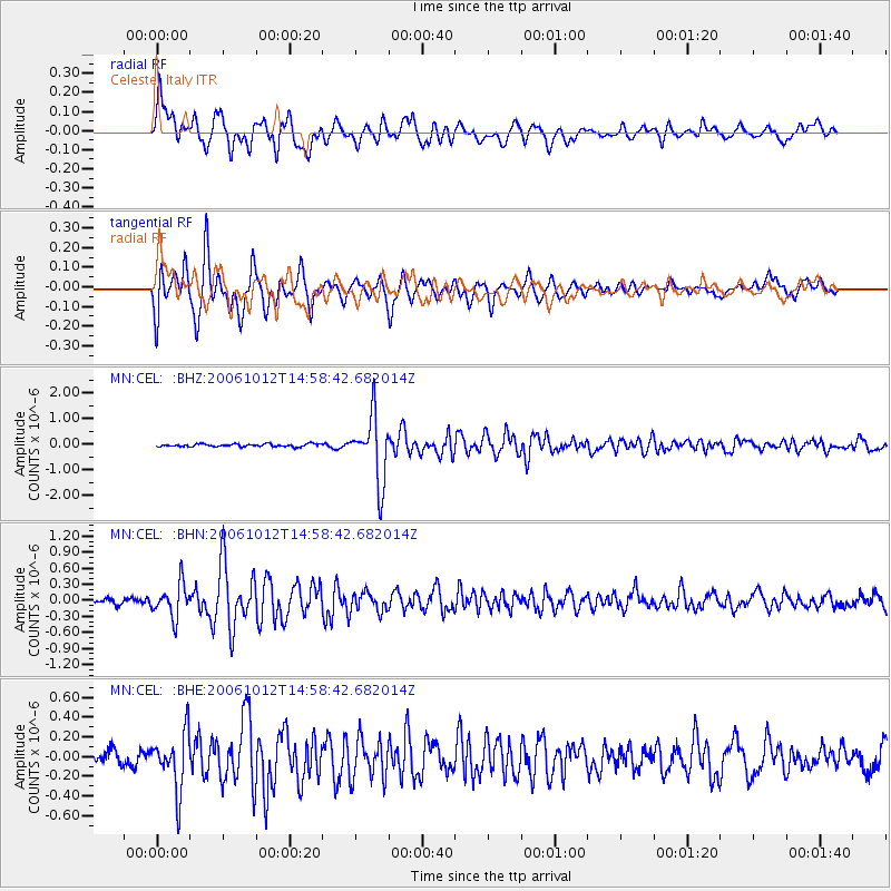
Signal To Noise
| Channel | StoN | STA | LTA |
| MN:CEL: :BHN:20061012T14:58:42.682014Z | 4.9660964 | 3.0866602E-7 | 6.215466E-8 |
| MN:CEL: :BHE:20061012T14:58:42.682014Z | 3.6569884 | 2.8992716E-7 | 7.928031E-8 |
| MN:CEL: :BHZ:20061012T14:58:42.682014Z | 23.331156 | 1.2919334E-6 | 5.537374E-8 |
| Arrivals |
| Ps | 2.3 SECOND |
| PpPs | 9.0 SECOND |
| PsPs/PpSs | 11 SECOND |


