CEL Celeste, Italy - Earthquake Result Viewer
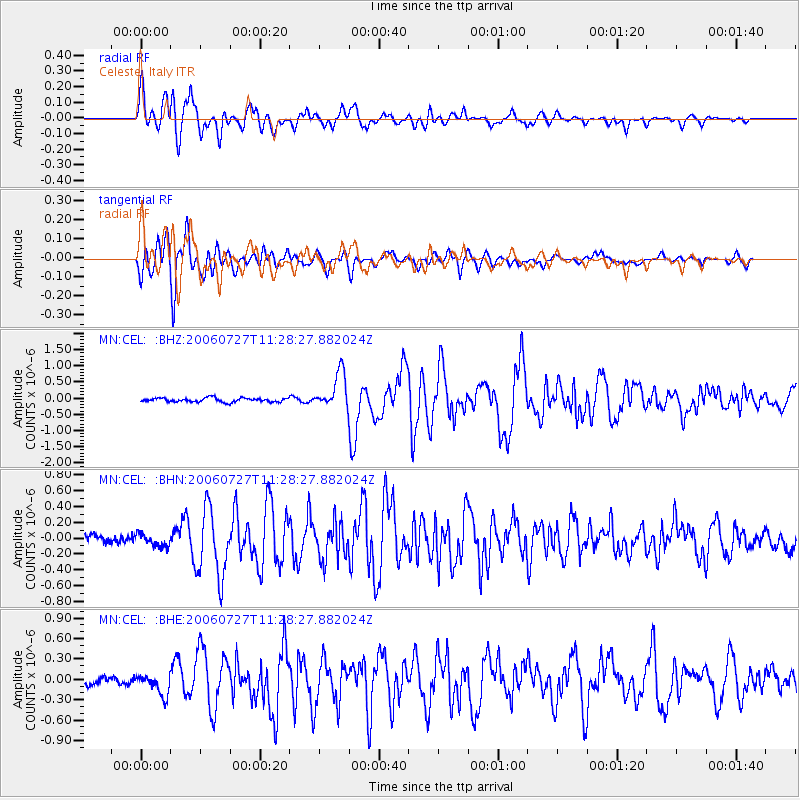
Earthquake location: Northern Sumatra, Indonesia
Earthquake latitude/longitude: 1.7/97.1
Earthquake time(UTC): 2006/07/27 (208) 11:16:40 GMT
Earthquake Depth: 20 km
Earthquake Magnitude: 5.6 MB, 6.1 MS, 6.1 MW, 6.0 MW
Earthquake Catalog/Contributor: WHDF/NEIC
Network: MN MEDNET Project
Station: CEL Celeste, Italy
Lat/Lon: 38.26 N/15.89 E
Elevation: 702 m
Distance: 82.1 deg
Az: 308.226 deg
Baz: 94.079 deg
Ray Param: 0.047122836
Estimated Moho Depth: 19.0 km
Estimated Crust Vp/Vs: 1.60
Assumed Crust Vp: 5.782 km/s
Estimated Crust Vs: 3.614 km/s
Estimated Crust Poisson's Ratio: 0.18
Radial Match: 90.92903 %
Radial Bump: 400
Transverse Match: 91.940346 %
Transverse Bump: 400
SOD ConfigId: 2665
Insert Time: 2010-03-08 16:53:20.030 +0000
GWidth: 2.5
Max Bumps: 400
Tol: 0.001

Signal To Noise

ChannelStoNSTALTA
MN:CEL: :BHN:20060727T11:28:27.882024Z1.52067617.787062E-85.120789E-8
MN:CEL: :BHE:20060727T11:28:27.882024Z2.2244451.5915671E-77.1548946E-8
MN:CEL: :BHZ:20060727T11:28:27.882024Z9.0318095.577477E-76.175371E-8
Arrivals
Ps2.0 SECOND
PpPs8.3 SECOND
PsPs/PpSs10 SECOND