You are here: Home > Network List > MN - MEDNET Project Stations List
> Station CEL Celeste, Italy > Earthquake Result Viewer
CEL Celeste, Italy - Earthquake Result Viewer

| Earthquake location: |
Taiwan Region |
| Earthquake latitude/longitude: |
22.9/121.3 |
| Earthquake time(UTC): |
2006/04/01 (091) 10:02:19 GMT |
| Earthquake Depth: |
9.0 km |
| Earthquake Magnitude: |
6.0 MB, 6.1 MS, 6.2 MW, 6.1 MW |
| Earthquake Catalog/Contributor: |
WHDF/NEIC |
|
| Network: |
MN MEDNET Project |
| Station: |
CEL Celeste, Italy |
| Lat/Lon: |
38.26 N/15.89 E |
| Elevation: |
702 m |
|
| Distance: |
87.4 deg |
| Az: |
310.553 deg |
| Baz: |
62.9 deg |
| Ray Param: |
0.04336563 |
| Estimated Moho Depth: |
34.0 km |
| Estimated Crust Vp/Vs: |
1.97 |
| Assumed Crust Vp: |
5.782 km/s |
| Estimated Crust Vs: |
2.939 km/s |
| Estimated Crust Poisson's Ratio: |
0.33 |
|
| Radial Match: |
94.62612 % |
| Radial Bump: |
400 |
| Transverse Match: |
96.23988 % |
| Transverse Bump: |
400 |
| SOD ConfigId: |
2669 |
| Insert Time: |
2010-03-08 16:53:37.236 +0000 |
| GWidth: |
2.5 |
| Max Bumps: |
400 |
| Tol: |
0.001 |
|
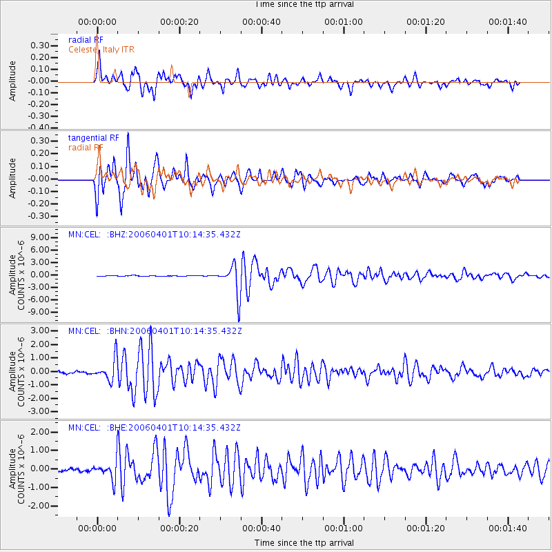
Signal To Noise
| Channel | StoN | STA | LTA |
| MN:CEL: :BHN:20060401T10:14:35.432Z | 11.888466 | 8.571713E-7 | 7.210109E-8 |
| MN:CEL: :BHE:20060401T10:14:35.432Z | 8.204068 | 5.12692E-7 | 6.249242E-8 |
| MN:CEL: :BHZ:20060401T10:14:35.432Z | 42.56003 | 3.7889915E-6 | 8.902699E-8 |
| Arrivals |
| Ps | 5.8 SECOND |
| PpPs | 17 SECOND |
| PsPs/PpSs | 23 SECOND |


