CEL Celeste, Italy - Earthquake Result Viewer
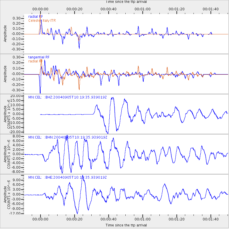
Earthquake location: Near S. Coast Of Western Honshu
Earthquake latitude/longitude: 33.1/136.6
Earthquake time(UTC): 2004/09/05 (249) 10:07:07 GMT
Earthquake Depth: 14 km
Earthquake Magnitude: 6.7 MB, 7.0 MS, 7.2 MW, 7.0 MW
Earthquake Catalog/Contributor: WHDF/NEIC
Network: MN MEDNET Project
Station: CEL Celeste, Italy
Lat/Lon: 38.26 N/15.89 E
Elevation: 702 m
Distance: 90.2 deg
Az: 317.411 deg
Baz: 46.205 deg
Ray Param: 0.041692507
Estimated Moho Depth: 31.75 km
Estimated Crust Vp/Vs: 2.10
Assumed Crust Vp: 5.782 km/s
Estimated Crust Vs: 2.76 km/s
Estimated Crust Poisson's Ratio: 0.35
Radial Match: 94.15769 %
Radial Bump: 341
Transverse Match: 86.45864 %
Transverse Bump: 400
SOD ConfigId: 2459
Insert Time: 2010-03-08 16:53:39.702 +0000
GWidth: 2.5
Max Bumps: 400
Tol: 0.001

Signal To Noise

ChannelStoNSTALTA
MN:CEL: :BHN:20040905T10:19:35.939019Z18.1420351.7303732E-69.537923E-8
MN:CEL: :BHE:20040905T10:19:35.939019Z10.2471178.3270476E-78.126234E-8
MN:CEL: :BHZ:20040905T10:19:35.939019Z79.893275.370999E-66.722718E-8
Arrivals
Ps6.1 SECOND
PpPs17 SECOND
PsPs/PpSs23 SECOND