CEL Celeste, Italy - Earthquake Result Viewer
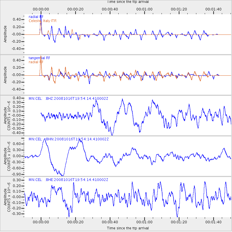
Earthquake location: Near Coast Of Chiapas, Mexico
Earthquake latitude/longitude: 14.4/-92.4
Earthquake time(UTC): 2008/10/16 (290) 19:41:25 GMT
Earthquake Depth: 24 km
Earthquake Magnitude: 6.1 MB, 6.6 MS, 6.7 MW, 6.6 MW
Earthquake Catalog/Contributor: WHDF/NEIC
Network: MN MEDNET Project
Station: CEL Celeste, Italy
Lat/Lon: 38.26 N/15.89 E
Elevation: 702 m
Distance: 95.0 deg
Az: 48.624 deg
Baz: 292.549 deg
Ray Param: 0.04090284
Estimated Moho Depth: 41.25 km
Estimated Crust Vp/Vs: 1.87
Assumed Crust Vp: 5.782 km/s
Estimated Crust Vs: 3.088 km/s
Estimated Crust Poisson's Ratio: 0.30
Radial Match: 82.821846 %
Radial Bump: 400
Transverse Match: 71.92238 %
Transverse Bump: 400
SOD ConfigId: 2556
Insert Time: 2010-03-08 16:54:21.095 +0000
GWidth: 2.5
Max Bumps: 400
Tol: 0.001

Signal To Noise

ChannelStoNSTALTA
MN:CEL: :BHN:20081016T19:54:14.410002Z13.5961275.742149E-74.223371E-8
MN:CEL: :BHE:20081016T19:54:14.410002Z1.1818197.500697E-86.3467404E-8
MN:CEL: :BHZ:20081016T19:54:14.410002Z5.3827262.1581673E-74.0094314E-8
Arrivals
Ps6.3 SECOND
PpPs20 SECOND
PsPs/PpSs27 SECOND