CEL Celeste, Italy - Earthquake Result Viewer
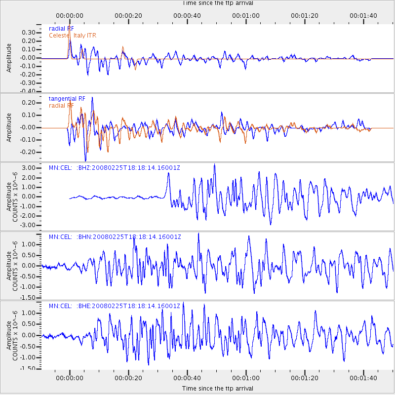
Earthquake location: Southern Sumatra, Indonesia
Earthquake latitude/longitude: -2.3/99.9
Earthquake time(UTC): 2008/02/25 (056) 18:06:03 GMT
Earthquake Depth: 25 km
Earthquake Magnitude: 6.0 MB, 6.4 MS, 6.4 MW, 6.3 MW
Earthquake Catalog/Contributor: WHDF/NEIC
Network: MN MEDNET Project
Station: CEL Celeste, Italy
Lat/Lon: 38.26 N/15.89 E
Elevation: 702 m
Distance: 86.7 deg
Az: 308.354 deg
Baz: 95.533 deg
Ray Param: 0.043824263
Estimated Moho Depth: 18.25 km
Estimated Crust Vp/Vs: 1.66
Assumed Crust Vp: 5.782 km/s
Estimated Crust Vs: 3.483 km/s
Estimated Crust Poisson's Ratio: 0.22
Radial Match: 92.98888 %
Radial Bump: 400
Transverse Match: 94.29708 %
Transverse Bump: 400
SOD ConfigId: 2564
Insert Time: 2010-03-08 16:54:29.474 +0000
GWidth: 2.5
Max Bumps: 400
Tol: 0.001

Signal To Noise

ChannelStoNSTALTA
MN:CEL: :BHN:20080225T18:18:14.16001Z2.3381951.276225E-75.4581626E-8
MN:CEL: :BHE:20080225T18:18:14.16001Z2.63100081.380182E-75.245844E-8
MN:CEL: :BHZ:20080225T18:18:14.16001Z10.4705749.1405394E-78.72974E-8
Arrivals
Ps2.1 SECOND
PpPs8.2 SECOND
PsPs/PpSs10 SECOND