You are here: Home > Network List > G - GEOSCOPE Stations List
> Station INU Inuyama, Japan > Earthquake Result Viewer
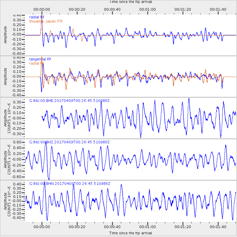
INU Inuyama, Japan - Earthquake Result Viewer
*The percent match for this event was below the threshold and hence no stack was calculated.
| Earthquake location: |
West Of Macquarie Island |
| Earthquake latitude/longitude: |
-52.2/139.7 |
| Earthquake time(UTC): |
2017/04/09 (099) 00:14:30 GMT |
| Earthquake Depth: |
10 km |
| Earthquake Magnitude: |
5.5 Mww |
| Earthquake Catalog/Contributor: |
NEIC PDE/us |
|
| Network: |
G GEOSCOPE |
| Station: |
INU Inuyama, Japan |
| Lat/Lon: |
35.35 N/137.03 E |
| Elevation: |
132 m |
|
| Distance: |
87.2 deg |
| Az: |
357.843 deg |
| Baz: |
178.376 deg |
| Ray Param: |
$rayparam |
*The percent match for this event was below the threshold and hence was not used in the summary stack. |
|
| Radial Match: |
50.72977 % |
| Radial Bump: |
400 |
| Transverse Match: |
64.69534 % |
| Transverse Bump: |
400 |
| SOD ConfigId: |
2028011 |
| Insert Time: |
2017-04-26 04:12:24.910 +0000 |
| GWidth: |
2.5 |
| Max Bumps: |
400 |
| Tol: |
0.001 |
|
Signal To Noise
| Channel | StoN | STA | LTA |
| G:INU:00:BHZ:20170409T00:26:45.510986Z | 2.47469 | 4.117325E-7 | 1.663774E-7 |
| G:INU:00:BHN:20170409T00:26:45.510986Z | 1.9738448 | 2.6275356E-7 | 1.3311765E-7 |
| G:INU:00:BHE:20170409T00:26:45.510986Z | 1.7182244 | 1.4764258E-7 | 8.592741E-8 |
| Arrivals |
| Ps | |
| PpPs | |
| PsPs/PpSs | |


