You are here: Home > Network List > II - Global Seismograph Network (GSN - IRIS/IDA) Stations List
> Station WRAB Tennant Creek, NT, Australia > Earthquake Result Viewer
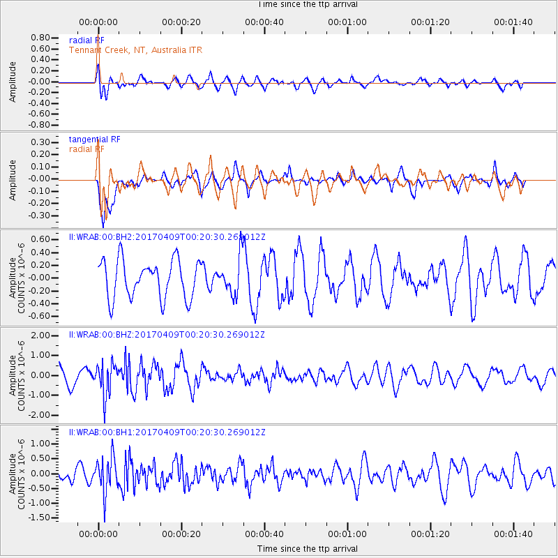
WRAB Tennant Creek, NT, Australia - Earthquake Result Viewer
*The percent match for this event was below the threshold and hence no stack was calculated.
| Earthquake location: |
West Of Macquarie Island |
| Earthquake latitude/longitude: |
-52.2/139.7 |
| Earthquake time(UTC): |
2017/04/09 (099) 00:14:30 GMT |
| Earthquake Depth: |
10 km |
| Earthquake Magnitude: |
5.5 Mww |
| Earthquake Catalog/Contributor: |
NEIC PDE/us |
|
| Network: |
II Global Seismograph Network (GSN - IRIS/IDA) |
| Station: |
WRAB Tennant Creek, NT, Australia |
| Lat/Lon: |
19.93 S/134.36 E |
| Elevation: |
366 m |
|
| Distance: |
32.4 deg |
| Az: |
350.67 deg |
| Baz: |
173.909 deg |
| Ray Param: |
$rayparam |
*The percent match for this event was below the threshold and hence was not used in the summary stack. |
|
| Radial Match: |
71.03249 % |
| Radial Bump: |
400 |
| Transverse Match: |
67.215866 % |
| Transverse Bump: |
387 |
| SOD ConfigId: |
2028011 |
| Insert Time: |
2017-04-26 04:12:44.219 +0000 |
| GWidth: |
2.5 |
| Max Bumps: |
400 |
| Tol: |
0.001 |
|
Signal To Noise
| Channel | StoN | STA | LTA |
| II:WRAB:00:BHZ:20170409T00:20:30.269012Z | 1.6677037 | 7.9628103E-7 | 4.7747153E-7 |
| II:WRAB:00:BH1:20170409T00:20:30.269012Z | 2.5396833 | 5.9719054E-7 | 2.3514369E-7 |
| II:WRAB:00:BH2:20170409T00:20:30.269012Z | 1.0076702 | 2.9918945E-7 | 2.9691208E-7 |
| Arrivals |
| Ps | |
| PpPs | |
| PsPs/PpSs | |


