You are here: Home > Network List > MN - MEDNET Project Stations List
> Station CEL Celeste, Italy > Earthquake Result Viewer
CEL Celeste, Italy - Earthquake Result Viewer

| Earthquake location: |
Western Brazil |
| Earthquake latitude/longitude: |
-8.1/-71.3 |
| Earthquake time(UTC): |
2007/07/21 (202) 13:27:04 GMT |
| Earthquake Depth: |
645 km |
| Earthquake Magnitude: |
6.2 MB, 6.1 MW, 6.0 MW |
| Earthquake Catalog/Contributor: |
WHDF/NEIC |
|
| Network: |
MN MEDNET Project |
| Station: |
CEL Celeste, Italy |
| Lat/Lon: |
38.26 N/15.89 E |
| Elevation: |
702 m |
|
| Distance: |
92.8 deg |
| Az: |
51.922 deg |
| Baz: |
261.895 deg |
| Ray Param: |
0.040828396 |
| Estimated Moho Depth: |
10.0 km |
| Estimated Crust Vp/Vs: |
1.60 |
| Assumed Crust Vp: |
5.782 km/s |
| Estimated Crust Vs: |
3.614 km/s |
| Estimated Crust Poisson's Ratio: |
0.18 |
|
| Radial Match: |
98.89696 % |
| Radial Bump: |
36 |
| Transverse Match: |
98.934784 % |
| Transverse Bump: |
40 |
| SOD ConfigId: |
2564 |
| Insert Time: |
2010-03-08 16:55:37.055 +0000 |
| GWidth: |
2.5 |
| Max Bumps: |
400 |
| Tol: |
0.001 |
|
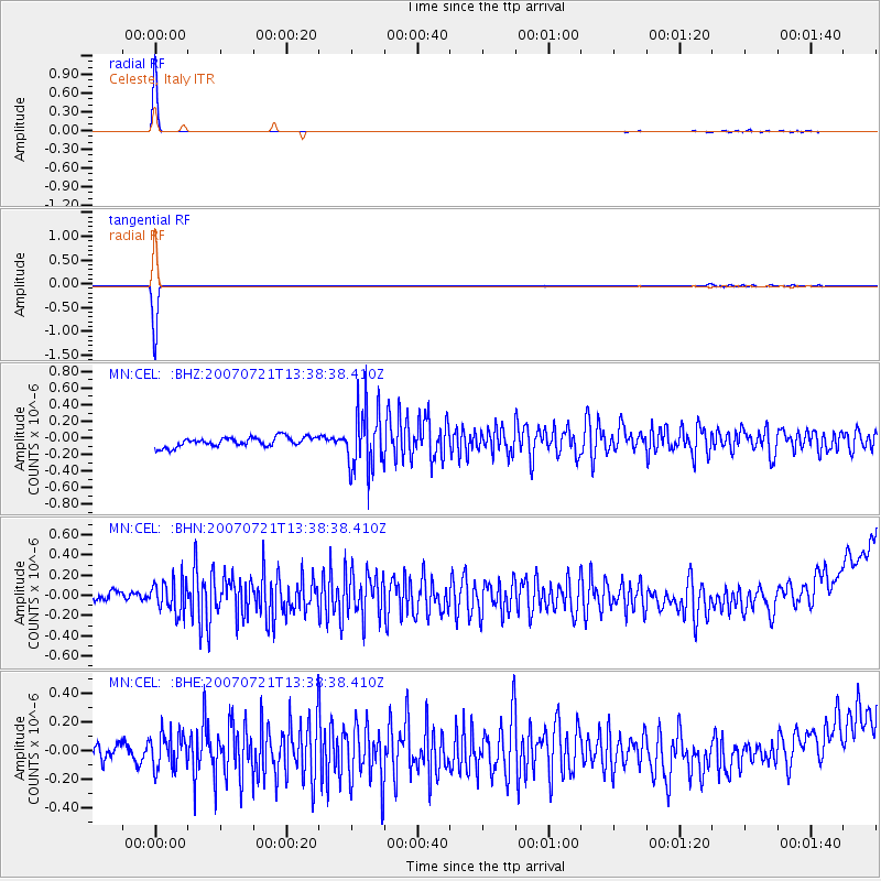
Signal To Noise
| Channel | StoN | STA | LTA |
| MN:CEL: :BHN:20070721T13:38:38.410Z | 2.9971063 | 1.5929079E-7 | 5.3148195E-8 |
| MN:CEL: :BHE:20070721T13:38:38.410Z | 2.415353 | 1.2280069E-7 | 5.0841717E-8 |
| MN:CEL: :BHZ:20070721T13:38:38.410Z | 6.4004054 | 3.715145E-7 | 5.8045465E-8 |
| Arrivals |
| Ps | 1.1 SECOND |
| PpPs | 4.4 SECOND |
| PsPs/PpSs | 5.5 SECOND |


