CEL Celeste, Italy - Earthquake Result Viewer
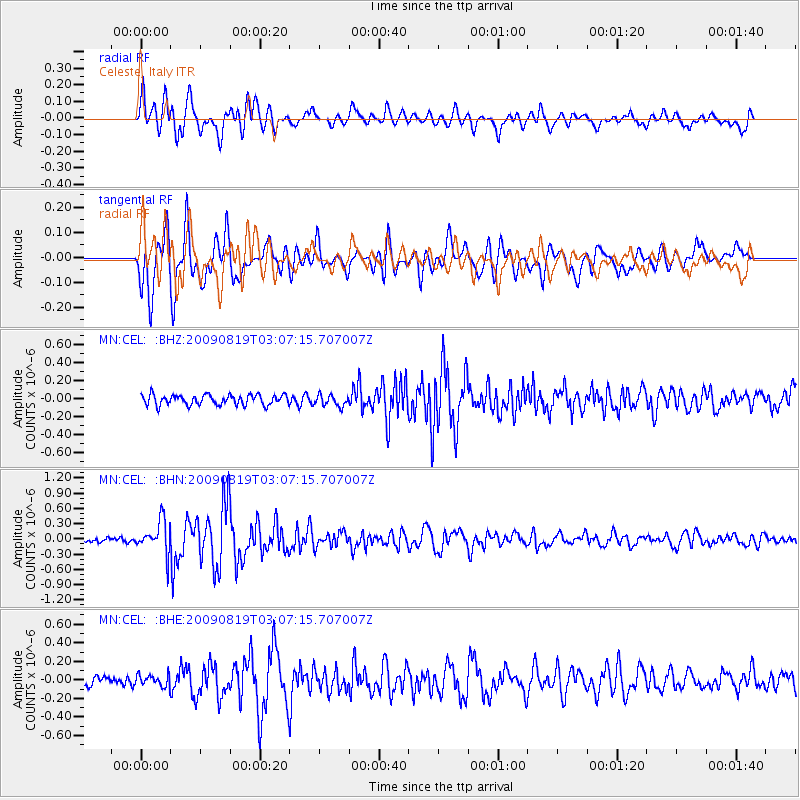
Earthquake location: Southern Sumatra, Indonesia
Earthquake latitude/longitude: -1.4/99.4
Earthquake time(UTC): 2009/08/19 (231) 02:55:08 GMT
Earthquake Depth: 10 km
Earthquake Magnitude: 5.5 MB, 5.2 MS, 5.5 MW, 5.5 MW
Earthquake Catalog/Contributor: WHDF/NEIC
Network: MN MEDNET Project
Station: CEL Celeste, Italy
Lat/Lon: 38.26 N/15.89 E
Elevation: 702 m
Distance: 85.7 deg
Az: 308.342 deg
Baz: 95.102 deg
Ray Param: 0.044569124
Estimated Moho Depth: 18.25 km
Estimated Crust Vp/Vs: 1.63
Assumed Crust Vp: 5.782 km/s
Estimated Crust Vs: 3.537 km/s
Estimated Crust Poisson's Ratio: 0.20
Radial Match: 86.38661 %
Radial Bump: 400
Transverse Match: 89.82279 %
Transverse Bump: 400
SOD ConfigId: 2622
Insert Time: 2010-03-08 16:55:49.247 +0000
GWidth: 2.5
Max Bumps: 400
Tol: 0.001

Signal To Noise

ChannelStoNSTALTA
MN:CEL: :BHN:20090819T03:07:15.707007Z7.2206463.240244E-74.4874714E-8
MN:CEL: :BHE:20090819T03:07:15.707007Z0.99980756.3484066E-86.349629E-8
MN:CEL: :BHZ:20090819T03:07:15.707007Z1.09625576.219034E-85.6729775E-8
Arrivals
Ps2.0 SECOND
PpPs8.1 SECOND
PsPs/PpSs10 SECOND