You are here: Home > Network List > TS - TERRAscope (Southern California Seismic Network) Stations List
> Station PAS Pasadena, California, USA > Earthquake Result Viewer
PAS Pasadena, California, USA - Earthquake Result Viewer
*The percent match for this event was below the threshold and hence no stack was calculated.
| Earthquake location: |
Tonga Islands |
| Earthquake latitude/longitude: |
-20.0/-175.9 |
| Earthquake time(UTC): |
1991/02/28 (059) 13:30:14 GMT |
| Earthquake Depth: |
220 km |
| Earthquake Magnitude: |
5.6 MB |
| Earthquake Catalog/Contributor: |
WHDF/NEIC |
|
| Network: |
TS TERRAscope (Southern California Seismic Network) |
| Station: |
PAS Pasadena, California, USA |
| Lat/Lon: |
34.15 N/118.17 W |
| Elevation: |
295 m |
|
| Distance: |
76.9 deg |
| Az: |
46.068 deg |
| Baz: |
234.752 deg |
| Ray Param: |
$rayparam |
*The percent match for this event was below the threshold and hence was not used in the summary stack. |
|
| Radial Match: |
64.8797 % |
| Radial Bump: |
400 |
| Transverse Match: |
72.1291 % |
| Transverse Bump: |
400 |
| SOD ConfigId: |
4480 |
| Insert Time: |
2010-02-26 14:38:41.191 +0000 |
| GWidth: |
2.5 |
| Max Bumps: |
400 |
| Tol: |
0.001 |
|
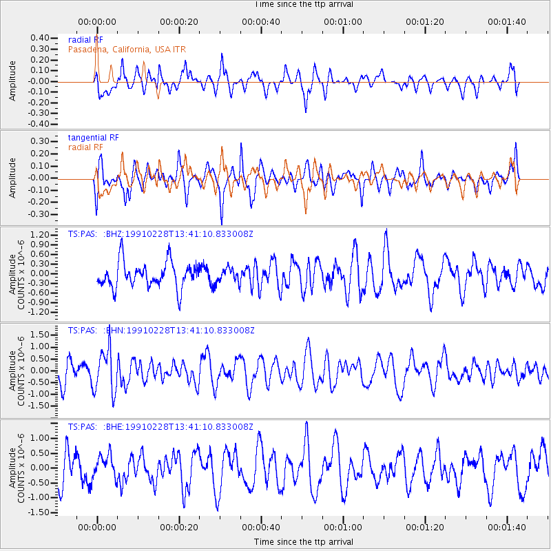
Signal To Noise
| Channel | StoN | STA | LTA |
| TS:PAS: :BHN:19910228T13:41:10.833008Z | 2.5872278 | 9.164412E-7 | 3.5421743E-7 |
| TS:PAS: :BHE:19910228T13:41:10.833008Z | 0.86460584 | 3.7463747E-7 | 4.333043E-7 |
| TS:PAS: :BHZ:19910228T13:41:10.833008Z | 0.52149224 | 2.0569277E-7 | 3.9443114E-7 |
| Arrivals |
| Ps | |
| PpPs | |
| PsPs/PpSs | |


