CEL Celeste, Italy - Earthquake Result Viewer
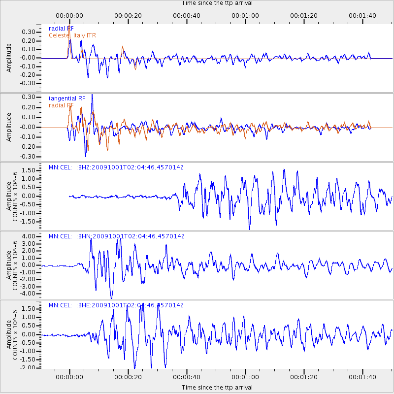
Earthquake location: Southern Sumatra, Indonesia
Earthquake latitude/longitude: -2.5/101.5
Earthquake time(UTC): 2009/10/01 (274) 01:52:27 GMT
Earthquake Depth: 9.7 km
Earthquake Magnitude: 5.9 MB, 6.7 MS, 6.6 MW, 6.6 MW
Earthquake Catalog/Contributor: WHDF/NEIC
Network: MN MEDNET Project
Station: CEL Celeste, Italy
Lat/Lon: 38.26 N/15.89 E
Elevation: 702 m
Distance: 88.1 deg
Az: 308.247 deg
Baz: 94.678 deg
Ray Param: 0.042847153
Estimated Moho Depth: 17.5 km
Estimated Crust Vp/Vs: 1.74
Assumed Crust Vp: 5.782 km/s
Estimated Crust Vs: 3.328 km/s
Estimated Crust Poisson's Ratio: 0.25
Radial Match: 94.202675 %
Radial Bump: 400
Transverse Match: 97.11444 %
Transverse Bump: 342
SOD ConfigId: 2622
Insert Time: 2010-03-08 16:56:02.239 +0000
GWidth: 2.5
Max Bumps: 400
Tol: 0.001

Signal To Noise

ChannelStoNSTALTA
MN:CEL: :BHN:20091001T02:04:46.457014Z3.7437191.7875874E-74.774897E-8
MN:CEL: :BHE:20091001T02:04:46.457014Z0.88935743.6256736E-84.0767343E-8
MN:CEL: :BHZ:20091001T02:04:46.457014Z1.46637386.540886E-84.460586E-8
Arrivals
Ps2.3 SECOND
PpPs8.1 SECOND
PsPs/PpSs10 SECOND