You are here: Home > Network List > AV - Alaska Volcano Observatory Stations List
> Station SPCR Ckakachatna River, Mount Spurr, Alaska > Earthquake Result Viewer
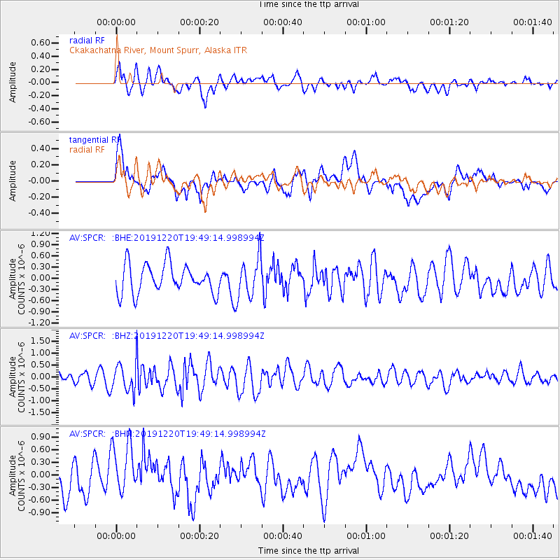
SPCR Ckakachatna River, Mount Spurr, Alaska - Earthquake Result Viewer
*The percent match for this event was below the threshold and hence no stack was calculated.
| Earthquake location: |
Southeast Of Honshu, Japan |
| Earthquake latitude/longitude: |
32.9/142.8 |
| Earthquake time(UTC): |
2019/12/20 (354) 19:40:52 GMT |
| Earthquake Depth: |
10 km |
| Earthquake Magnitude: |
5.3 Mww |
| Earthquake Catalog/Contributor: |
NEIC PDE/us |
|
| Network: |
AV Alaska Volcano Observatory |
| Station: |
SPCR Ckakachatna River, Mount Spurr, Alaska |
| Lat/Lon: |
61.20 N/152.21 W |
| Elevation: |
984 m |
|
| Distance: |
49.9 deg |
| Az: |
35.04 deg |
| Baz: |
266.291 deg |
| Ray Param: |
$rayparam |
*The percent match for this event was below the threshold and hence was not used in the summary stack. |
|
| Radial Match: |
61.963333 % |
| Radial Bump: |
400 |
| Transverse Match: |
58.394253 % |
| Transverse Bump: |
400 |
| SOD ConfigId: |
20465011 |
| Insert Time: |
2020-01-07 21:10:06.513 +0000 |
| GWidth: |
2.5 |
| Max Bumps: |
400 |
| Tol: |
0.001 |
|
Signal To Noise
| Channel | StoN | STA | LTA |
| AV:SPCR: :BHZ:20191220T19:49:14.998994Z | 2.323713 | 5.531186E-7 | 2.3803223E-7 |
| AV:SPCR: :BHN:20191220T19:49:14.998994Z | 1.6417725 | 6.19173E-7 | 3.771369E-7 |
| AV:SPCR: :BHE:20191220T19:49:14.998994Z | 1.2902396 | 4.971472E-7 | 3.8531385E-7 |
| Arrivals |
| Ps | |
| PpPs | |
| PsPs/PpSs | |


