You are here: Home > Network List > US - United States National Seismic Network Stations List
> Station AMTX Amarillo, Texas, USA > Earthquake Result Viewer
AMTX Amarillo, Texas, USA - Earthquake Result Viewer
*The percent match for this event was below the threshold and hence no stack was calculated.
| Earthquake location: |
Near Coast Of Central Chile |
| Earthquake latitude/longitude: |
-31.0/-71.4 |
| Earthquake time(UTC): |
2017/04/13 (103) 03:42:53 GMT |
| Earthquake Depth: |
43 km |
| Earthquake Magnitude: |
5.4 Mwr |
| Earthquake Catalog/Contributor: |
NEIC PDE/us |
|
| Network: |
US United States National Seismic Network |
| Station: |
AMTX Amarillo, Texas, USA |
| Lat/Lon: |
34.53 N/101.41 W |
| Elevation: |
1010 m |
|
| Distance: |
71.1 deg |
| Az: |
334.119 deg |
| Baz: |
153.01 deg |
| Ray Param: |
$rayparam |
*The percent match for this event was below the threshold and hence was not used in the summary stack. |
|
| Radial Match: |
67.134186 % |
| Radial Bump: |
400 |
| Transverse Match: |
67.77295 % |
| Transverse Bump: |
400 |
| SOD ConfigId: |
2028011 |
| Insert Time: |
2017-04-27 03:51:49.091 +0000 |
| GWidth: |
2.5 |
| Max Bumps: |
400 |
| Tol: |
0.001 |
|
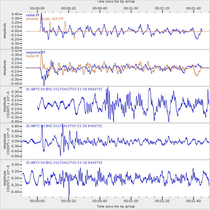
Signal To Noise
| Channel | StoN | STA | LTA |
| US:AMTX:00:BHZ:20170413T03:53:38.849976Z | 6.886994 | 3.6683647E-7 | 5.3265108E-8 |
| US:AMTX:00:BH1:20170413T03:53:38.849976Z | 1.6308286 | 1.4951304E-7 | 9.167918E-8 |
| US:AMTX:00:BH2:20170413T03:53:38.849976Z | 1.8359035 | 1.2472638E-7 | 6.793733E-8 |
| Arrivals |
| Ps | |
| PpPs | |
| PsPs/PpSs | |


