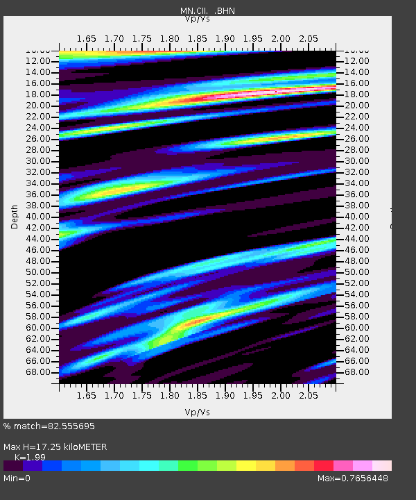
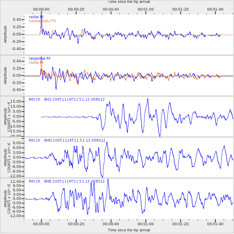
CII Isernia, Italy - Earthquake Result Viewer

Earthquake location: Off East Coast Of Honshu, Japan
Earthquake latitude/longitude: 38.1/144.9
Earthquake time(UTC): 2005/11/14 (318) 21:38:51 GMT
Earthquake Depth: 11 km
Earthquake Magnitude: 6.7 MB, 6.8 MS, 7.0 MW, 6.9 MW
Earthquake Catalog/Contributor: WHDF/NEIC
Network: MN MEDNET Project
Station: CII Isernia, Italy
Lat/Lon: 41.72 N/14.31 E
Elevation: 910 m
Distance: 88.7 deg
Az: 325.347 deg
Baz: 36.813 deg
Ray Param: 0.04241343
Estimated Moho Depth: 17.25 km
Estimated Crust Vp/Vs: 1.99
Assumed Crust Vp: 6.1 km/s
Estimated Crust Vs: 3.065 km/s
Estimated Crust Poisson's Ratio: 0.33
Radial Match: 82.555695 %
Radial Bump: 400
Transverse Match: 78.76998 %
Transverse Bump: 400
SOD ConfigId: 2448
Insert Time: 2010-03-08 16:57:33.162 +0000
GWidth: 2.5
Max Bumps: 400
Tol: 0.001

Signal To Noise

ChannelStoNSTALTA
MN:CII: :BHN:20051114T21:51:13.06801Z3.192735.73895E-71.7975056E-7
MN:CII: :BHE:20051114T21:51:13.06801Z1.36626913.369662E-72.4663237E-7
MN:CII: :BHZ:20051114T21:51:13.06801Z13.4711182.6787511E-61.9885144E-7
Arrivals
Ps2.8 SECOND
PpPs8.3 SECOND
PsPs/PpSs11 SECOND