You are here: Home > Network List > MN - MEDNET Project Stations List
> Station CII Isernia, Italy > Earthquake Result Viewer
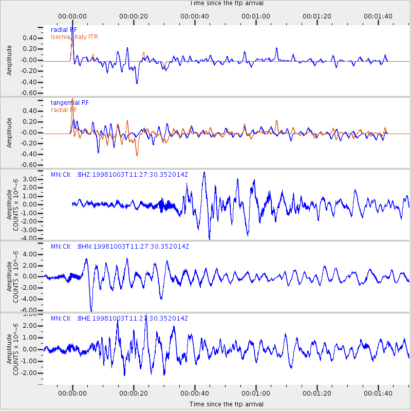
CII Isernia, Italy - Earthquake Result Viewer
*The percent match for this event was below the threshold and hence no stack was calculated.
| Earthquake location: |
Northwest Of Ryukyu Islands |
| Earthquake latitude/longitude: |
28.5/127.6 |
| Earthquake time(UTC): |
1998/10/03 (276) 11:15:42 GMT |
| Earthquake Depth: |
227 km |
| Earthquake Magnitude: |
5.6 MB, 6.1 UNKNOWN, 6.1 MW |
| Earthquake Catalog/Contributor: |
WHDF/NEIC |
|
| Network: |
MN MEDNET Project |
| Station: |
CII Isernia, Italy |
| Lat/Lon: |
41.72 N/14.31 E |
| Elevation: |
910 m |
|
| Distance: |
86.9 deg |
| Az: |
316.489 deg |
| Baz: |
54.043 deg |
| Ray Param: |
$rayparam |
*The percent match for this event was below the threshold and hence was not used in the summary stack. |
|
| Radial Match: |
56.562767 % |
| Radial Bump: |
400 |
| Transverse Match: |
63.353455 % |
| Transverse Bump: |
400 |
| SOD ConfigId: |
4480 |
| Insert Time: |
2010-03-08 16:57:47.396 +0000 |
| GWidth: |
2.5 |
| Max Bumps: |
400 |
| Tol: |
0.001 |
|
Signal To Noise
| Channel | StoN | STA | LTA |
| MN:CII: :BHN:19981003T11:27:30.352014Z | 6.0307617 | 1.2548367E-6 | 2.0807268E-7 |
| MN:CII: :BHE:19981003T11:27:30.352014Z | 1.845075 | 2.5587926E-7 | 1.3868231E-7 |
| MN:CII: :BHZ:19981003T11:27:30.352014Z | 2.2146983 | 4.9878946E-7 | 2.2521779E-7 |
| Arrivals |
| Ps | |
| PpPs | |
| PsPs/PpSs | |


