You are here: Home > Network List > MN - MEDNET Project Stations List
> Station CII Isernia, Italy > Earthquake Result Viewer
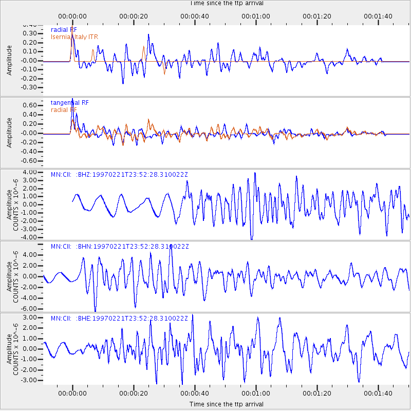
CII Isernia, Italy - Earthquake Result Viewer
*The percent match for this event was below the threshold and hence no stack was calculated.
| Earthquake location: |
East Of Kuril Islands |
| Earthquake latitude/longitude: |
43.8/149.2 |
| Earthquake time(UTC): |
1997/02/21 (052) 23:40:24 GMT |
| Earthquake Depth: |
33 km |
| Earthquake Magnitude: |
6.1 MB, 5.6 MS, 6.1 UNKNOWN, 6.1 MW |
| Earthquake Catalog/Contributor: |
WHDF/NEIC |
|
| Network: |
MN MEDNET Project |
| Station: |
CII Isernia, Italy |
| Lat/Lon: |
41.72 N/14.31 E |
| Elevation: |
910 m |
|
| Distance: |
85.7 deg |
| Az: |
327.851 deg |
| Baz: |
30.961 deg |
| Ray Param: |
$rayparam |
*The percent match for this event was below the threshold and hence was not used in the summary stack. |
|
| Radial Match: |
82.81166 % |
| Radial Bump: |
400 |
| Transverse Match: |
73.89048 % |
| Transverse Bump: |
400 |
| SOD ConfigId: |
4480 |
| Insert Time: |
2010-03-08 16:57:55.967 +0000 |
| GWidth: |
2.5 |
| Max Bumps: |
400 |
| Tol: |
0.001 |
|
Signal To Noise
| Channel | StoN | STA | LTA |
| MN:CII: :BHN:19970221T23:52:28.310022Z | 2.9979255 | 1.6240258E-6 | 5.4171653E-7 |
| MN:CII: :BHE:19970221T23:52:28.310022Z | 0.58710307 | 2.2476173E-7 | 3.8283181E-7 |
| MN:CII: :BHZ:19970221T23:52:28.310022Z | 1.5867976 | 1.2223762E-6 | 7.703416E-7 |
| Arrivals |
| Ps | |
| PpPs | |
| PsPs/PpSs | |


