You are here: Home > Network List > MN - MEDNET Project Stations List
> Station CII Isernia, Italy > Earthquake Result Viewer
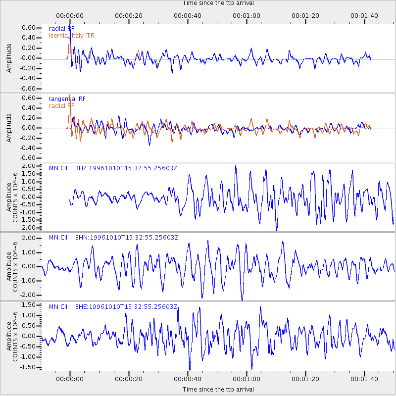
CII Isernia, Italy - Earthquake Result Viewer
*The percent match for this event was below the threshold and hence no stack was calculated.
| Earthquake location: |
Northern Sumatra, Indonesia |
| Earthquake latitude/longitude: |
3.4/97.9 |
| Earthquake time(UTC): |
1996/10/10 (284) 15:21:04 GMT |
| Earthquake Depth: |
33 km |
| Earthquake Magnitude: |
5.7 MB, 6.1 MS, 6.3 UNKNOWN, 6.2 MW |
| Earthquake Catalog/Contributor: |
WHDF/NEIC |
|
| Network: |
MN MEDNET Project |
| Station: |
CII Isernia, Italy |
| Lat/Lon: |
41.72 N/14.31 E |
| Elevation: |
910 m |
|
| Distance: |
83.0 deg |
| Az: |
311.443 deg |
| Baz: |
91.655 deg |
| Ray Param: |
$rayparam |
*The percent match for this event was below the threshold and hence was not used in the summary stack. |
|
| Radial Match: |
63.550076 % |
| Radial Bump: |
400 |
| Transverse Match: |
55.646465 % |
| Transverse Bump: |
400 |
| SOD ConfigId: |
4480 |
| Insert Time: |
2010-03-08 16:59:10.360 +0000 |
| GWidth: |
2.5 |
| Max Bumps: |
400 |
| Tol: |
0.001 |
|
Signal To Noise
| Channel | StoN | STA | LTA |
| MN:CII: :BHN:19961010T15:32:55.25603Z | 2.4851162 | 5.828256E-7 | 2.3452648E-7 |
| MN:CII: :BHE:19961010T15:32:55.25603Z | 1.0354365 | 2.30804E-7 | 2.2290503E-7 |
| MN:CII: :BHZ:19961010T15:32:55.25603Z | 1.0323598 | 2.837493E-7 | 2.74855E-7 |
| Arrivals |
| Ps | |
| PpPs | |
| PsPs/PpSs | |


