You are here: Home > Network List > IW - Intermountain West Stations List
> Station IMW Indian Meadow, Wyoming, USA > Earthquake Result Viewer
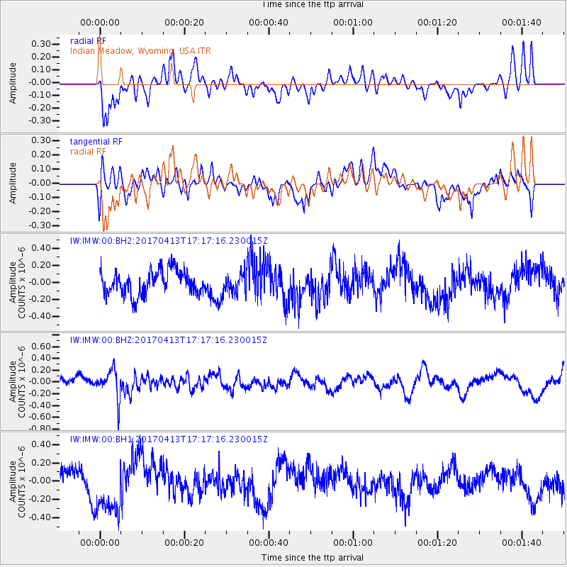
IMW Indian Meadow, Wyoming, USA - Earthquake Result Viewer
*The percent match for this event was below the threshold and hence no stack was calculated.
| Earthquake location: |
Fiji Islands Region |
| Earthquake latitude/longitude: |
-18.3/-178.2 |
| Earthquake time(UTC): |
2017/04/13 (103) 17:05:54 GMT |
| Earthquake Depth: |
494 km |
| Earthquake Magnitude: |
5.8 Mww |
| Earthquake Catalog/Contributor: |
NEIC PDE/us |
|
| Network: |
IW Intermountain West |
| Station: |
IMW Indian Meadow, Wyoming, USA |
| Lat/Lon: |
43.90 N/110.94 W |
| Elevation: |
2646 m |
|
| Distance: |
87.1 deg |
| Az: |
41.863 deg |
| Baz: |
241.297 deg |
| Ray Param: |
$rayparam |
*The percent match for this event was below the threshold and hence was not used in the summary stack. |
|
| Radial Match: |
47.233456 % |
| Radial Bump: |
400 |
| Transverse Match: |
41.122673 % |
| Transverse Bump: |
400 |
| SOD ConfigId: |
2028011 |
| Insert Time: |
2017-04-27 17:08:17.011 +0000 |
| GWidth: |
2.5 |
| Max Bumps: |
400 |
| Tol: |
0.001 |
|
Signal To Noise
| Channel | StoN | STA | LTA |
| IW:IMW:00:BHZ:20170413T17:17:16.230015Z | 2.3969483 | 2.4251105E-7 | 1.01174926E-7 |
| IW:IMW:00:BH1:20170413T17:17:16.230015Z | 2.5116067 | 3.0801564E-7 | 1.226369E-7 |
| IW:IMW:00:BH2:20170413T17:17:16.230015Z | 0.81686485 | 1.1541485E-7 | 1.4129002E-7 |
| Arrivals |
| Ps | |
| PpPs | |
| PsPs/PpSs | |


