You are here: Home > Network List > US - United States National Seismic Network Stations List
> Station CBKS Cedar Bluff, Kansas, USA > Earthquake Result Viewer
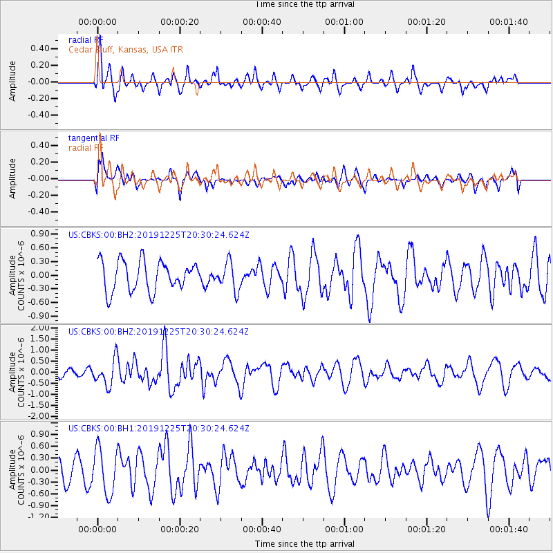
CBKS Cedar Bluff, Kansas, USA - Earthquake Result Viewer
*The percent match for this event was below the threshold and hence no stack was calculated.
| Earthquake location: |
Southern East Pacific Rise |
| Earthquake latitude/longitude: |
-25.3/-116.0 |
| Earthquake time(UTC): |
2019/12/25 (359) 20:20:12 GMT |
| Earthquake Depth: |
10 km |
| Earthquake Magnitude: |
5.8 Mww |
| Earthquake Catalog/Contributor: |
NEIC PDE/us |
|
| Network: |
US United States National Seismic Network |
| Station: |
CBKS Cedar Bluff, Kansas, USA |
| Lat/Lon: |
38.81 N/99.74 W |
| Elevation: |
677 m |
|
| Distance: |
65.5 deg |
| Az: |
13.917 deg |
| Baz: |
196.186 deg |
| Ray Param: |
$rayparam |
*The percent match for this event was below the threshold and hence was not used in the summary stack. |
|
| Radial Match: |
60.198048 % |
| Radial Bump: |
400 |
| Transverse Match: |
59.426357 % |
| Transverse Bump: |
400 |
| SOD ConfigId: |
20465011 |
| Insert Time: |
2020-01-08 20:37:43.577 +0000 |
| GWidth: |
2.5 |
| Max Bumps: |
400 |
| Tol: |
0.001 |
|
Signal To Noise
| Channel | StoN | STA | LTA |
| US:CBKS:00:BHZ:20191225T20:30:24.624Z | 3.684393 | 6.2092226E-7 | 1.685277E-7 |
| US:CBKS:00:BH1:20191225T20:30:24.624Z | 1.8593559 | 5.887694E-7 | 3.1665235E-7 |
| US:CBKS:00:BH2:20191225T20:30:24.624Z | 0.9748452 | 3.201392E-7 | 3.2840006E-7 |
| Arrivals |
| Ps | |
| PpPs | |
| PsPs/PpSs | |


