You are here: Home > Network List > TA - USArray Transportable Network (new EarthScope stations) Stations List
> Station D25K Kavik River, AK, USA > Earthquake Result Viewer
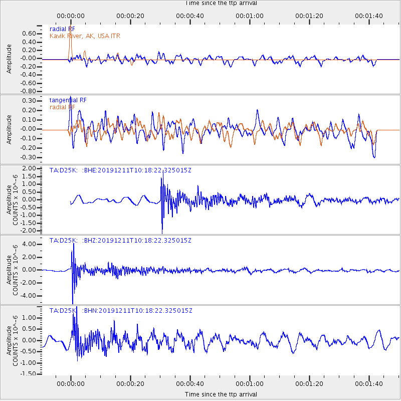
D25K Kavik River, AK, USA - Earthquake Result Viewer
*The percent match for this event was below the threshold and hence no stack was calculated.
| Earthquake location: |
Kuril Islands |
| Earthquake latitude/longitude: |
48.9/154.8 |
| Earthquake time(UTC): |
2019/12/11 (345) 10:12:07 GMT |
| Earthquake Depth: |
35 km |
| Earthquake Magnitude: |
5.1 Mww |
| Earthquake Catalog/Contributor: |
NEIC PDE/us |
|
| Network: |
TA USArray Transportable Network (new EarthScope stations) |
| Station: |
D25K Kavik River, AK, USA |
| Lat/Lon: |
69.32 N/146.38 W |
| Elevation: |
770 m |
|
| Distance: |
34.6 deg |
| Az: |
32.393 deg |
| Baz: |
264.677 deg |
| Ray Param: |
$rayparam |
*The percent match for this event was below the threshold and hence was not used in the summary stack. |
|
| Radial Match: |
52.54212 % |
| Radial Bump: |
400 |
| Transverse Match: |
62.40605 % |
| Transverse Bump: |
400 |
| SOD ConfigId: |
20465011 |
| Insert Time: |
2020-01-09 12:28:14.626 +0000 |
| GWidth: |
2.5 |
| Max Bumps: |
400 |
| Tol: |
0.001 |
|
Signal To Noise
| Channel | StoN | STA | LTA |
| TA:D25K: :BHZ:20191211T10:18:22.325015Z | 8.121917 | 1.5198403E-6 | 1.8712828E-7 |
| TA:D25K: :BHN:20191211T10:18:22.325015Z | 3.2215676 | 5.3000315E-7 | 1.6451715E-7 |
| TA:D25K: :BHE:20191211T10:18:22.325015Z | 4.241531 | 6.9933486E-7 | 1.6487795E-7 |
| Arrivals |
| Ps | |
| PpPs | |
| PsPs/PpSs | |


