You are here: Home > Network List > WY - Yellowstone Wyoming Seismic Network Stations List
> Station YHH Holmes Hill, YNP, WY, USA > Earthquake Result Viewer
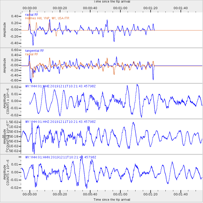
YHH Holmes Hill, YNP, WY, USA - Earthquake Result Viewer
*The percent match for this event was below the threshold and hence no stack was calculated.
| Earthquake location: |
Kuril Islands |
| Earthquake latitude/longitude: |
48.9/154.8 |
| Earthquake time(UTC): |
2019/12/11 (345) 10:12:07 GMT |
| Earthquake Depth: |
35 km |
| Earthquake Magnitude: |
5.1 Mww |
| Earthquake Catalog/Contributor: |
NEIC PDE/us |
|
| Network: |
WY Yellowstone Wyoming Seismic Network |
| Station: |
YHH Holmes Hill, YNP, WY, USA |
| Lat/Lon: |
44.79 N/110.85 W |
| Elevation: |
2717 m |
|
| Distance: |
60.5 deg |
| Az: |
54.626 deg |
| Baz: |
310.892 deg |
| Ray Param: |
$rayparam |
*The percent match for this event was below the threshold and hence was not used in the summary stack. |
|
| Radial Match: |
45.349167 % |
| Radial Bump: |
276 |
| Transverse Match: |
52.75405 % |
| Transverse Bump: |
400 |
| SOD ConfigId: |
20465011 |
| Insert Time: |
2020-01-09 12:31:20.500 +0000 |
| GWidth: |
2.5 |
| Max Bumps: |
400 |
| Tol: |
0.001 |
|
Signal To Noise
| Channel | StoN | STA | LTA |
| WY:YHH:01:HHZ:20191211T10:21:43.45798Z | 1.4218991 | 7.591954E-9 | 5.3393054E-9 |
| WY:YHH:01:HHN:20191211T10:21:43.45798Z | 2.3655894 | 9.622922E-9 | 4.0678754E-9 |
| WY:YHH:01:HHE:20191211T10:21:43.45798Z | 0.49344575 | 5.5001914E-9 | 1.1146497E-8 |
| Arrivals |
| Ps | |
| PpPs | |
| PsPs/PpSs | |


