You are here: Home > Network List > TA - USArray Transportable Network (new EarthScope stations) Stations List
> Station H16K Elim, AK, USA > Earthquake Result Viewer
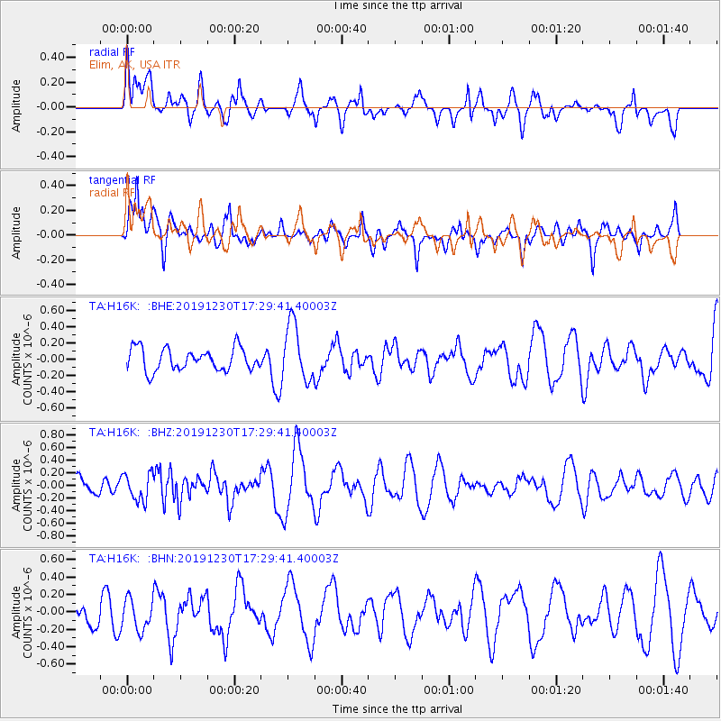
H16K Elim, AK, USA - Earthquake Result Viewer
*The percent match for this event was below the threshold and hence no stack was calculated.
| Earthquake location: |
Northwestern Kashmir |
| Earthquake latitude/longitude: |
35.6/74.6 |
| Earthquake time(UTC): |
2019/12/30 (364) 17:18:57 GMT |
| Earthquake Depth: |
13 km |
| Earthquake Magnitude: |
5.4 Mww |
| Earthquake Catalog/Contributor: |
NEIC PDE/us |
|
| Network: |
TA USArray Transportable Network (new EarthScope stations) |
| Station: |
H16K Elim, AK, USA |
| Lat/Lon: |
64.64 N/162.24 W |
| Elevation: |
216 m |
|
| Distance: |
70.7 deg |
| Az: |
22.465 deg |
| Baz: |
313.683 deg |
| Ray Param: |
$rayparam |
*The percent match for this event was below the threshold and hence was not used in the summary stack. |
|
| Radial Match: |
55.600304 % |
| Radial Bump: |
400 |
| Transverse Match: |
70.109024 % |
| Transverse Bump: |
400 |
| SOD ConfigId: |
20465011 |
| Insert Time: |
2020-01-13 17:26:54.969 +0000 |
| GWidth: |
2.5 |
| Max Bumps: |
400 |
| Tol: |
0.001 |
|
Signal To Noise
| Channel | StoN | STA | LTA |
| TA:H16K: :BHZ:20191230T17:29:41.40003Z | 1.500831 | 2.162963E-7 | 1.4411769E-7 |
| TA:H16K: :BHN:20191230T17:29:41.40003Z | 0.7915444 | 1.7708727E-7 | 2.2372375E-7 |
| TA:H16K: :BHE:20191230T17:29:41.40003Z | 2.560224 | 3.5074675E-7 | 1.3699847E-7 |
| Arrivals |
| Ps | |
| PpPs | |
| PsPs/PpSs | |


