You are here: Home > Network List > US - United States National Seismic Network Stations List
> Station HDIL Hopedale, Illinois, USA > Earthquake Result Viewer
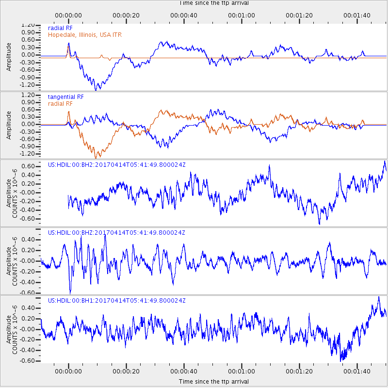
HDIL Hopedale, Illinois, USA - Earthquake Result Viewer
*The percent match for this event was below the threshold and hence no stack was calculated.
| Earthquake location: |
Southern Mid-Atlantic Ridge |
| Earthquake latitude/longitude: |
-12.4/-14.8 |
| Earthquake time(UTC): |
2017/04/14 (104) 05:29:38 GMT |
| Earthquake Depth: |
10 km |
| Earthquake Magnitude: |
5.5 mb |
| Earthquake Catalog/Contributor: |
NEIC PDE/us |
|
| Network: |
US United States National Seismic Network |
| Station: |
HDIL Hopedale, Illinois, USA |
| Lat/Lon: |
40.56 N/89.29 W |
| Elevation: |
219 m |
|
| Distance: |
86.5 deg |
| Az: |
312.649 deg |
| Baz: |
109.414 deg |
| Ray Param: |
$rayparam |
*The percent match for this event was below the threshold and hence was not used in the summary stack. |
|
| Radial Match: |
48.242188 % |
| Radial Bump: |
400 |
| Transverse Match: |
51.791 % |
| Transverse Bump: |
400 |
| SOD ConfigId: |
2028011 |
| Insert Time: |
2017-04-28 05:33:43.739 +0000 |
| GWidth: |
2.5 |
| Max Bumps: |
400 |
| Tol: |
0.001 |
|
Signal To Noise
| Channel | StoN | STA | LTA |
| US:HDIL:00:BHZ:20170414T05:41:49.800024Z | 3.4054017 | 2.6619387E-7 | 7.816813E-8 |
| US:HDIL:00:BH1:20170414T05:41:49.800024Z | 1.1934028 | 1.294799E-7 | 1.08496394E-7 |
| US:HDIL:00:BH2:20170414T05:41:49.800024Z | 0.82801676 | 1.3731741E-7 | 1.6583893E-7 |
| Arrivals |
| Ps | |
| PpPs | |
| PsPs/PpSs | |


