You are here: Home > Network List > CN - Canadian National Seismograph Network Stations List
> Station INK INUVIK, NT > Earthquake Result Viewer
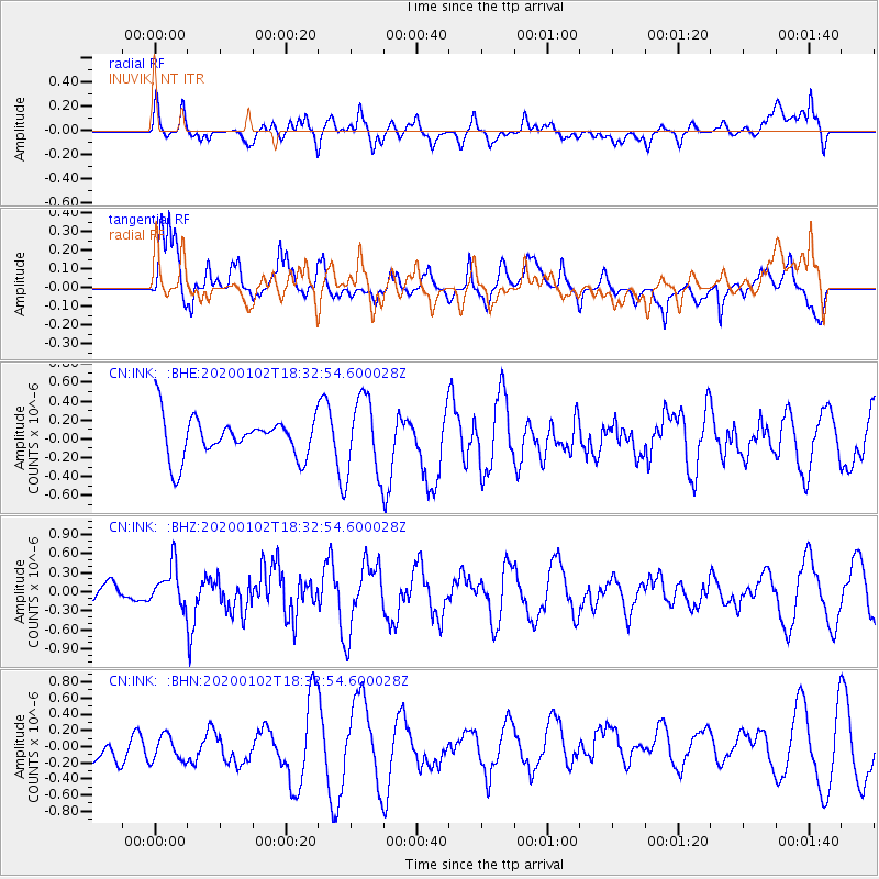
INK INUVIK, NT - Earthquake Result Viewer
*The percent match for this event was below the threshold and hence no stack was calculated.
| Earthquake location: |
Near East Coast Of Honshu, Japan |
| Earthquake latitude/longitude: |
35.8/141.1 |
| Earthquake time(UTC): |
2020/01/02 (002) 18:23:51 GMT |
| Earthquake Depth: |
17 km |
| Earthquake Magnitude: |
5.6 Mww |
| Earthquake Catalog/Contributor: |
NEIC PDE/us |
|
| Network: |
CN Canadian National Seismograph Network |
| Station: |
INK INUVIK, NT |
| Lat/Lon: |
68.31 N/133.53 W |
| Elevation: |
44 m |
|
| Distance: |
55.6 deg |
| Az: |
26.692 deg |
| Baz: |
280.847 deg |
| Ray Param: |
$rayparam |
*The percent match for this event was below the threshold and hence was not used in the summary stack. |
|
| Radial Match: |
41.58633 % |
| Radial Bump: |
400 |
| Transverse Match: |
68.422134 % |
| Transverse Bump: |
400 |
| SOD ConfigId: |
20465011 |
| Insert Time: |
2020-01-16 18:28:49.324 +0000 |
| GWidth: |
2.5 |
| Max Bumps: |
400 |
| Tol: |
0.001 |
|
Signal To Noise
| Channel | StoN | STA | LTA |
| CN:INK: :BHZ:20200102T18:32:54.600028Z | 1.1970887 | 3.1588573E-7 | 2.638783E-7 |
| CN:INK: :BHN:20200102T18:32:54.600028Z | 0.69145256 | 2.0947168E-7 | 3.0294441E-7 |
| CN:INK: :BHE:20200102T18:32:54.600028Z | 1.9369503 | 4.164573E-7 | 2.1500672E-7 |
| Arrivals |
| Ps | |
| PpPs | |
| PsPs/PpSs | |


