DIVS Divcibare,Serbia - Earthquake Result Viewer
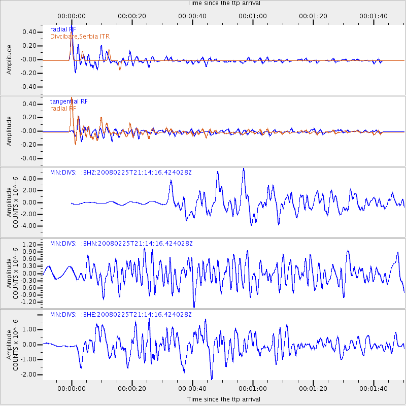
Earthquake location: Southern Sumatra, Indonesia
Earthquake latitude/longitude: -2.2/99.8
Earthquake time(UTC): 2008/02/25 (056) 21:02:18 GMT
Earthquake Depth: 25 km
Earthquake Magnitude: 6.2 MB, 6.6 MS, 6.6 MW, 6.5 MW
Earthquake Catalog/Contributor: WHDF/NEIC
Network: MN MEDNET Project
Station: DIVS Divcibare,Serbia
Lat/Lon: 44.10 N/19.99 E
Elevation: 1000 m
Distance: 84.2 deg
Az: 314.543 deg
Baz: 98.703 deg
Ray Param: 0.04559408
Estimated Moho Depth: 11.75 km
Estimated Crust Vp/Vs: 2.10
Assumed Crust Vp: 6.264 km/s
Estimated Crust Vs: 2.986 km/s
Estimated Crust Poisson's Ratio: 0.35
Radial Match: 93.458725 %
Radial Bump: 400
Transverse Match: 79.93527 %
Transverse Bump: 400
SOD ConfigId: 2564
Insert Time: 2010-03-08 17:04:00.664 +0000
GWidth: 2.5
Max Bumps: 400
Tol: 0.001

Signal To Noise

ChannelStoNSTALTA
MN:DIVS: :BHN:20080225T21:14:16.424028Z1.06298581.9651206E-71.84868E-7
MN:DIVS: :BHE:20080225T21:14:16.424028Z4.44515376.0320843E-71.3570025E-7
MN:DIVS: :BHZ:20080225T21:14:16.424028Z8.9789781.4594272E-61.6253821E-7
Arrivals
Ps2.1 SECOND
PpPs5.7 SECOND
PsPs/PpSs7.8 SECOND