You are here: Home > Network List > TA - USArray Transportable Network (new EarthScope stations) Stations List
> Station C16K Lisburne Hills, AK, USA > Earthquake Result Viewer
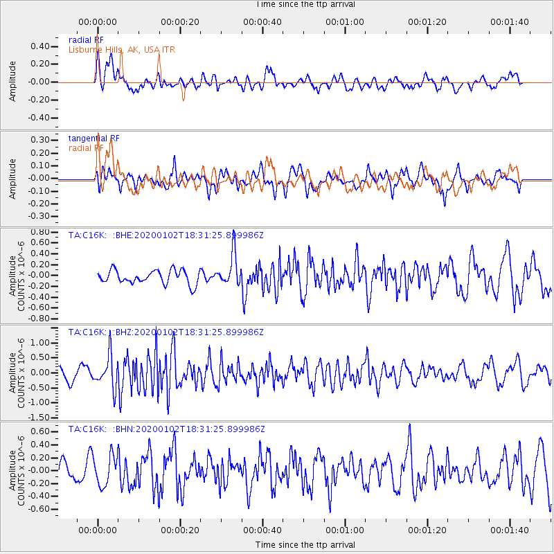
C16K Lisburne Hills, AK, USA - Earthquake Result Viewer
*The percent match for this event was below the threshold and hence no stack was calculated.
| Earthquake location: |
Near East Coast Of Honshu, Japan |
| Earthquake latitude/longitude: |
35.8/141.1 |
| Earthquake time(UTC): |
2020/01/02 (002) 18:23:51 GMT |
| Earthquake Depth: |
17 km |
| Earthquake Magnitude: |
5.6 Mww |
| Earthquake Catalog/Contributor: |
NEIC PDE/us |
|
| Network: |
TA USArray Transportable Network (new EarthScope stations) |
| Station: |
C16K Lisburne Hills, AK, USA |
| Lat/Lon: |
68.27 N/165.34 W |
| Elevation: |
102 m |
|
| Distance: |
43.9 deg |
| Az: |
25.575 deg |
| Baz: |
250.483 deg |
| Ray Param: |
$rayparam |
*The percent match for this event was below the threshold and hence was not used in the summary stack. |
|
| Radial Match: |
57.242855 % |
| Radial Bump: |
400 |
| Transverse Match: |
55.43909 % |
| Transverse Bump: |
400 |
| SOD ConfigId: |
20465011 |
| Insert Time: |
2020-01-16 18:36:49.612 +0000 |
| GWidth: |
2.5 |
| Max Bumps: |
400 |
| Tol: |
0.001 |
|
Signal To Noise
| Channel | StoN | STA | LTA |
| TA:C16K: :BHZ:20200102T18:31:25.899986Z | 2.8358903 | 5.5800314E-7 | 1.9676472E-7 |
| TA:C16K: :BHN:20200102T18:31:25.899986Z | 0.97755516 | 2.3426782E-7 | 2.3964665E-7 |
| TA:C16K: :BHE:20200102T18:31:25.899986Z | 2.4319441 | 3.0370163E-7 | 1.2488017E-7 |
| Arrivals |
| Ps | |
| PpPs | |
| PsPs/PpSs | |


