DIVS Divcibare,Serbia - Earthquake Result Viewer
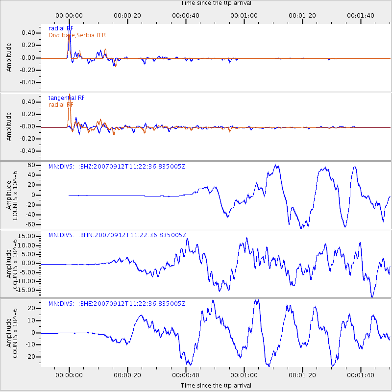
Earthquake location: Southern Sumatra, Indonesia
Earthquake latitude/longitude: -4.4/101.4
Earthquake time(UTC): 2007/09/12 (255) 11:10:26 GMT
Earthquake Depth: 34 km
Earthquake Magnitude: 6.9 MB, 8.5 MS, 8.4 MW, 8.0 ME
Earthquake Catalog/Contributor: WHDF/NEIC
Network: MN MEDNET Project
Station: DIVS Divcibare,Serbia
Lat/Lon: 44.10 N/19.99 E
Elevation: 1000 m
Distance: 86.9 deg
Az: 314.489 deg
Baz: 99.166 deg
Ray Param: 0.043684043
Estimated Moho Depth: 29.5 km
Estimated Crust Vp/Vs: 1.67
Assumed Crust Vp: 6.264 km/s
Estimated Crust Vs: 3.745 km/s
Estimated Crust Poisson's Ratio: 0.22
Radial Match: 98.86126 %
Radial Bump: 321
Transverse Match: 96.5728 %
Transverse Bump: 400
SOD ConfigId: 2564
Insert Time: 2010-03-08 17:04:46.330 +0000
GWidth: 2.5
Max Bumps: 400
Tol: 0.001

Signal To Noise

ChannelStoNSTALTA
MN:DIVS: :BHN:20070912T11:22:36.835005Z2.4071382.05822E-78.5504865E-8
MN:DIVS: :BHE:20070912T11:22:36.835005Z5.46531634.9346454E-79.029021E-8
MN:DIVS: :BHZ:20070912T11:22:36.835005Z3.23455831.1129742E-63.4408848E-7
Arrivals
Ps3.2 SECOND
PpPs12 SECOND
PsPs/PpSs16 SECOND