You are here: Home > Network List > IU - Global Seismograph Network (GSN - IRIS/USGS) Stations List
> Station RSSD Black Hills, South Dakota, USA > Earthquake Result Viewer
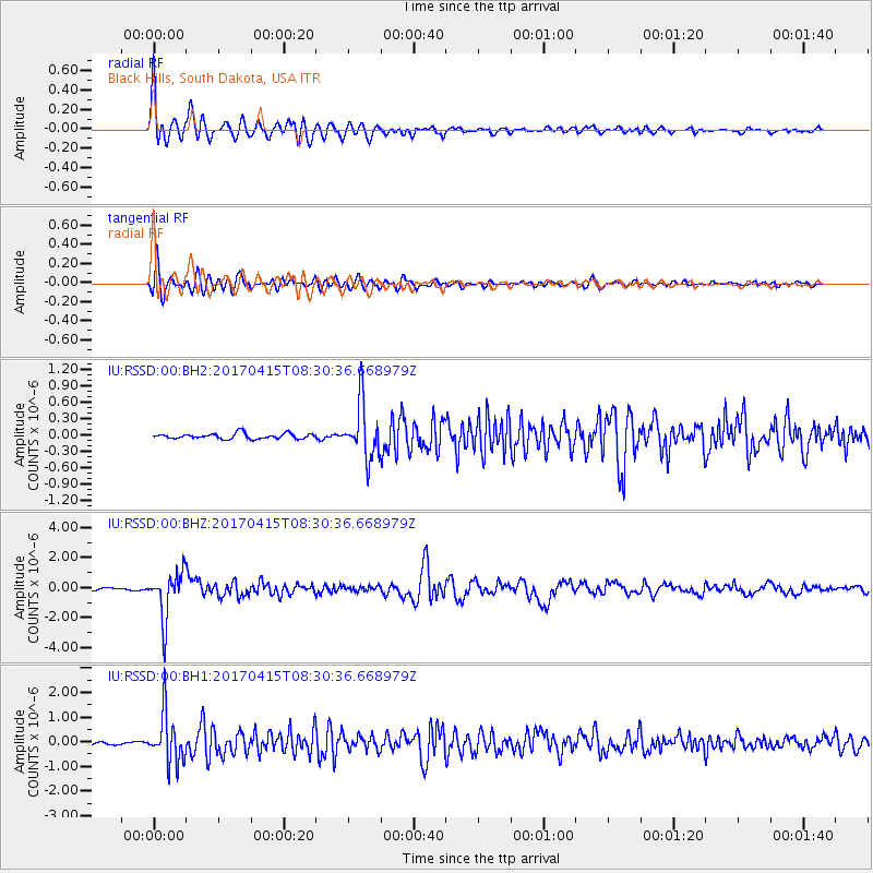
RSSD Black Hills, South Dakota, USA - Earthquake Result Viewer
*The percent match for this event was below the threshold and hence no stack was calculated.
| Earthquake location: |
Chile-Argentina Border Region |
| Earthquake latitude/longitude: |
-23.2/-67.7 |
| Earthquake time(UTC): |
2017/04/15 (105) 08:19:41 GMT |
| Earthquake Depth: |
135 km |
| Earthquake Magnitude: |
6.2 Mww |
| Earthquake Catalog/Contributor: |
NEIC PDE/us |
|
| Network: |
IU Global Seismograph Network (GSN - IRIS/USGS) |
| Station: |
RSSD Black Hills, South Dakota, USA |
| Lat/Lon: |
44.12 N/104.04 W |
| Elevation: |
2090 m |
|
| Distance: |
74.9 deg |
| Az: |
333.732 deg |
| Baz: |
145.58 deg |
| Ray Param: |
$rayparam |
*The percent match for this event was below the threshold and hence was not used in the summary stack. |
|
| Radial Match: |
94.189575 % |
| Radial Bump: |
400 |
| Transverse Match: |
89.06598 % |
| Transverse Bump: |
400 |
| SOD ConfigId: |
2028011 |
| Insert Time: |
2017-04-29 08:30:24.172 +0000 |
| GWidth: |
2.5 |
| Max Bumps: |
400 |
| Tol: |
0.001 |
|
Signal To Noise
| Channel | StoN | STA | LTA |
| IU:RSSD:00:BHZ:20170415T08:30:36.668979Z | 22.27064 | 1.5728891E-6 | 7.0626136E-8 |
| IU:RSSD:00:BH1:20170415T08:30:36.668979Z | 17.40798 | 9.927031E-7 | 5.7025748E-8 |
| IU:RSSD:00:BH2:20170415T08:30:36.668979Z | 9.894752 | 5.050024E-7 | 5.1037397E-8 |
| Arrivals |
| Ps | |
| PpPs | |
| PsPs/PpSs | |


