You are here: Home > Network List > TA - USArray Transportable Network (new EarthScope stations) Stations List
> Station I30M Mount Dempster, Yukon, CAN > Earthquake Result Viewer
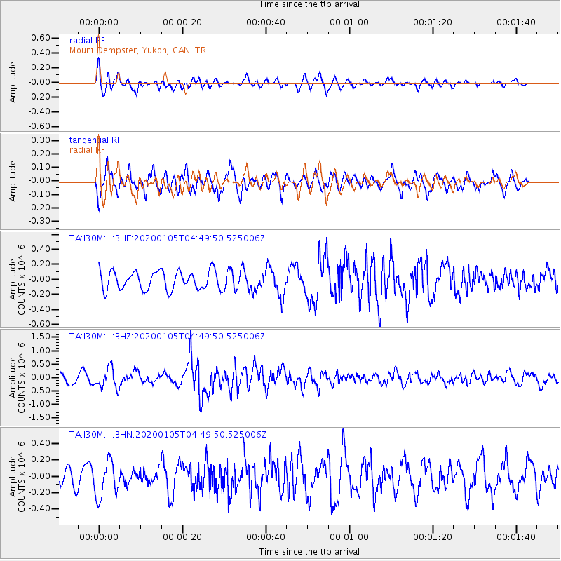
I30M Mount Dempster, Yukon, CAN - Earthquake Result Viewer
*The percent match for this event was below the threshold and hence no stack was calculated.
| Earthquake location: |
Oaxaca, Mexico |
| Earthquake latitude/longitude: |
16.4/-94.3 |
| Earthquake time(UTC): |
2020/01/05 (005) 04:40:50 GMT |
| Earthquake Depth: |
97 km |
| Earthquake Magnitude: |
5.8 Mww |
| Earthquake Catalog/Contributor: |
NEIC PDE/us |
|
| Network: |
TA USArray Transportable Network (new EarthScope stations) |
| Station: |
I30M Mount Dempster, Yukon, CAN |
| Lat/Lon: |
65.22 N/136.38 W |
| Elevation: |
1399 m |
|
| Distance: |
56.3 deg |
| Az: |
340.169 deg |
| Baz: |
129.415 deg |
| Ray Param: |
$rayparam |
*The percent match for this event was below the threshold and hence was not used in the summary stack. |
|
| Radial Match: |
64.597664 % |
| Radial Bump: |
400 |
| Transverse Match: |
65.7731 % |
| Transverse Bump: |
400 |
| SOD ConfigId: |
20465011 |
| Insert Time: |
2020-01-19 04:52:26.161 +0000 |
| GWidth: |
2.5 |
| Max Bumps: |
400 |
| Tol: |
0.001 |
|
Signal To Noise
| Channel | StoN | STA | LTA |
| TA:I30M: :BHZ:20200105T04:49:50.525006Z | 3.1249127 | 3.791577E-7 | 1.2133385E-7 |
| TA:I30M: :BHN:20200105T04:49:50.525006Z | 2.5188434 | 2.2312021E-7 | 8.858043E-8 |
| TA:I30M: :BHE:20200105T04:49:50.525006Z | 1.2783425 | 1.4870729E-7 | 1.16328195E-7 |
| Arrivals |
| Ps | |
| PpPs | |
| PsPs/PpSs | |


