You are here: Home > Network List > UW - Pacific Northwest Regional Seismic Network Stations List
> Station HOOD Mt Hood Meadows, OR CREST BB SMO > Earthquake Result Viewer
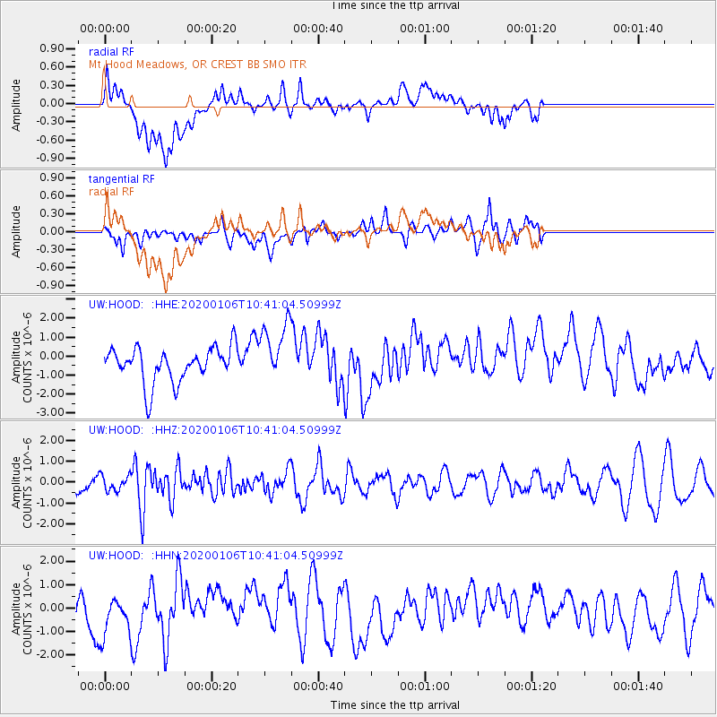
HOOD Mt Hood Meadows, OR CREST BB SMO - Earthquake Result Viewer
*The percent match for this event was below the threshold and hence no stack was calculated.
| Earthquake location: |
Puerto Rico Region |
| Earthquake latitude/longitude: |
17.9/-66.8 |
| Earthquake time(UTC): |
2020/01/06 (006) 10:32:18 GMT |
| Earthquake Depth: |
6.0 km |
| Earthquake Magnitude: |
5.8 mwp |
| Earthquake Catalog/Contributor: |
NEIC PDE/pr |
|
| Network: |
UW Pacific Northwest Regional Seismic Network |
| Station: |
HOOD Mt Hood Meadows, OR CREST BB SMO |
| Lat/Lon: |
45.32 N/121.65 W |
| Elevation: |
1520 m |
|
| Distance: |
52.9 deg |
| Az: |
313.693 deg |
| Baz: |
102.569 deg |
| Ray Param: |
$rayparam |
*The percent match for this event was below the threshold and hence was not used in the summary stack. |
|
| Radial Match: |
48.07507 % |
| Radial Bump: |
400 |
| Transverse Match: |
50.58362 % |
| Transverse Bump: |
400 |
| SOD ConfigId: |
20465011 |
| Insert Time: |
2020-01-20 10:46:58.624 +0000 |
| GWidth: |
2.5 |
| Max Bumps: |
400 |
| Tol: |
0.001 |
|
Signal To Noise
| Channel | StoN | STA | LTA |
| UW:HOOD: :HHZ:20200106T10:41:04.50999Z | 1.071615 | 3.6569296E-7 | 3.4125404E-7 |
| UW:HOOD: :HHN:20200106T10:41:04.50999Z | 1.1894051 | 9.490123E-7 | 7.978883E-7 |
| UW:HOOD: :HHE:20200106T10:41:04.50999Z | 1.7445097 | 1.5961584E-6 | 9.149611E-7 |
| Arrivals |
| Ps | |
| PpPs | |
| PsPs/PpSs | |


