You are here: Home > Network List > TA - USArray Transportable Network (new EarthScope stations) Stations List
> Station K13K Kusilvak Mountain, AK, USA > Earthquake Result Viewer
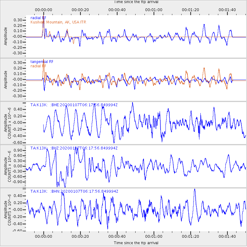
K13K Kusilvak Mountain, AK, USA - Earthquake Result Viewer
*The percent match for this event was below the threshold and hence no stack was calculated.
| Earthquake location: |
Northern Sumatra, Indonesia |
| Earthquake latitude/longitude: |
2.3/96.3 |
| Earthquake time(UTC): |
2020/01/07 (007) 06:05:20 GMT |
| Earthquake Depth: |
20 km |
| Earthquake Magnitude: |
6.2 Mww |
| Earthquake Catalog/Contributor: |
NEIC PDE/us |
|
| Network: |
TA USArray Transportable Network (new EarthScope stations) |
| Station: |
K13K Kusilvak Mountain, AK, USA |
| Lat/Lon: |
61.93 N/164.66 W |
| Elevation: |
204 m |
|
| Distance: |
92.2 deg |
| Az: |
27.871 deg |
| Baz: |
279.028 deg |
| Ray Param: |
$rayparam |
*The percent match for this event was below the threshold and hence was not used in the summary stack. |
|
| Radial Match: |
69.225975 % |
| Radial Bump: |
400 |
| Transverse Match: |
51.303406 % |
| Transverse Bump: |
400 |
| SOD ConfigId: |
20465011 |
| Insert Time: |
2020-01-21 06:12:07.360 +0000 |
| GWidth: |
2.5 |
| Max Bumps: |
400 |
| Tol: |
0.001 |
|
Signal To Noise
| Channel | StoN | STA | LTA |
| TA:K13K: :BHZ:20200107T06:17:56.849994Z | 3.6554384 | 4.91854E-7 | 1.3455403E-7 |
| TA:K13K: :BHN:20200107T06:17:56.849994Z | 1.1160077 | 1.5821244E-7 | 1.4176645E-7 |
| TA:K13K: :BHE:20200107T06:17:56.849994Z | 1.2385662 | 3.2304817E-7 | 2.6082432E-7 |
| Arrivals |
| Ps | |
| PpPs | |
| PsPs/PpSs | |


