You are here: Home > Network List > TA - USArray Transportable Network (new EarthScope stations) Stations List
> Station M11K Mekoryuk, AK, USA > Earthquake Result Viewer
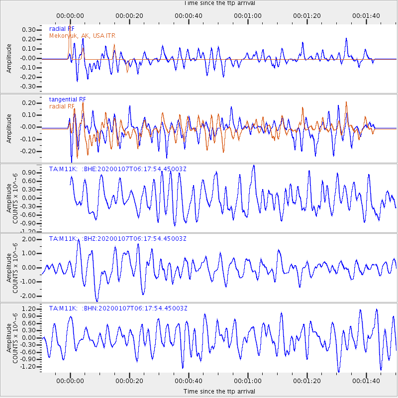
M11K Mekoryuk, AK, USA - Earthquake Result Viewer
*The percent match for this event was below the threshold and hence no stack was calculated.
| Earthquake location: |
Northern Sumatra, Indonesia |
| Earthquake latitude/longitude: |
2.3/96.3 |
| Earthquake time(UTC): |
2020/01/07 (007) 06:05:20 GMT |
| Earthquake Depth: |
20 km |
| Earthquake Magnitude: |
6.2 Mww |
| Earthquake Catalog/Contributor: |
NEIC PDE/us |
|
| Network: |
TA USArray Transportable Network (new EarthScope stations) |
| Station: |
M11K Mekoryuk, AK, USA |
| Lat/Lon: |
60.38 N/166.20 W |
| Elevation: |
3.0 m |
|
| Distance: |
91.7 deg |
| Az: |
29.518 deg |
| Baz: |
277.621 deg |
| Ray Param: |
$rayparam |
*The percent match for this event was below the threshold and hence was not used in the summary stack. |
|
| Radial Match: |
65.78655 % |
| Radial Bump: |
400 |
| Transverse Match: |
54.195602 % |
| Transverse Bump: |
400 |
| SOD ConfigId: |
20465011 |
| Insert Time: |
2020-01-21 06:12:15.820 +0000 |
| GWidth: |
2.5 |
| Max Bumps: |
400 |
| Tol: |
0.001 |
|
Signal To Noise
| Channel | StoN | STA | LTA |
| TA:M11K: :BHZ:20200107T06:17:54.45003Z | 2.7773993 | 9.488557E-7 | 3.416346E-7 |
| TA:M11K: :BHN:20200107T06:17:54.45003Z | 0.88540596 | 4.7682101E-7 | 5.385338E-7 |
| TA:M11K: :BHE:20200107T06:17:54.45003Z | 1.4698718 | 5.8733076E-7 | 3.995796E-7 |
| Arrivals |
| Ps | |
| PpPs | |
| PsPs/PpSs | |


