
IDI Anogia, Greece - Earthquake Result Viewer

| ||||||||||||||||||
| ||||||||||||||||||
| ||||||||||||||||||
|
Signal To Noise
| Channel | StoN | STA | LTA |
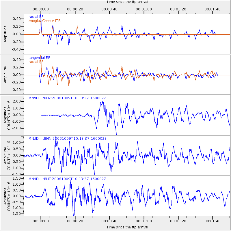
| MN:IDI: :BHN:20061009T10:13:37.160002Z | 5.3656807 | 4.1110482E-7 | 7.6617454E-8 |
| MN:IDI: :BHE:20061009T10:13:37.160002Z | 5.4181457 | 3.3889162E-7 | 6.2547535E-8 |
| MN:IDI: :BHZ:20061009T10:13:37.160002Z | 12.606206 | 9.241073E-7 | 7.330574E-8 |
| Arrivals | |
| Ps | 7.1 SECOND |
| PpPs | 22 SECOND |
| PsPs/PpSs | 29 SECOND |

