IDI Anogia, Greece - Earthquake Result Viewer
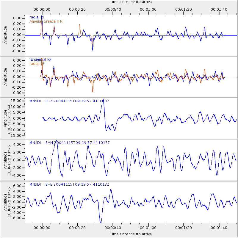
Earthquake location: Near West Coast Of Colombia
Earthquake latitude/longitude: 4.7/-77.5
Earthquake time(UTC): 2004/11/15 (320) 09:06:56 GMT
Earthquake Depth: 15 km
Earthquake Magnitude: 6.6 MB, 7.1 MS, 7.2 MW, 7.1 MW
Earthquake Catalog/Contributor: WHDF/NEIC
Network: MN MEDNET Project
Station: IDI Anogia, Greece
Lat/Lon: 35.29 N/24.89 E
Elevation: 750 m
Distance: 97.4 deg
Az: 53.674 deg
Baz: 281.021 deg
Ray Param: 0.040231038
Estimated Moho Depth: 50.5 km
Estimated Crust Vp/Vs: 1.61
Assumed Crust Vp: 5.627 km/s
Estimated Crust Vs: 3.489 km/s
Estimated Crust Poisson's Ratio: 0.19
Radial Match: 80.62033 %
Radial Bump: 400
Transverse Match: 61.97729 %
Transverse Bump: 399
SOD ConfigId: 2459
Insert Time: 2010-03-08 17:08:46.000 +0000
GWidth: 2.5
Max Bumps: 400
Tol: 0.001

Signal To Noise

ChannelStoNSTALTA
MN:IDI: :BHN:20041115T09:19:57.411013Z2.99984961.7419369E-65.8067474E-7
MN:IDI: :BHE:20041115T09:19:57.411013Z2.20454811.7233398E-67.817202E-7
MN:IDI: :BHZ:20041115T09:19:57.411013Z7.58649257.689169E-61.0135342E-6
Arrivals
Ps5.6 SECOND
PpPs23 SECOND
PsPs/PpSs29 SECOND