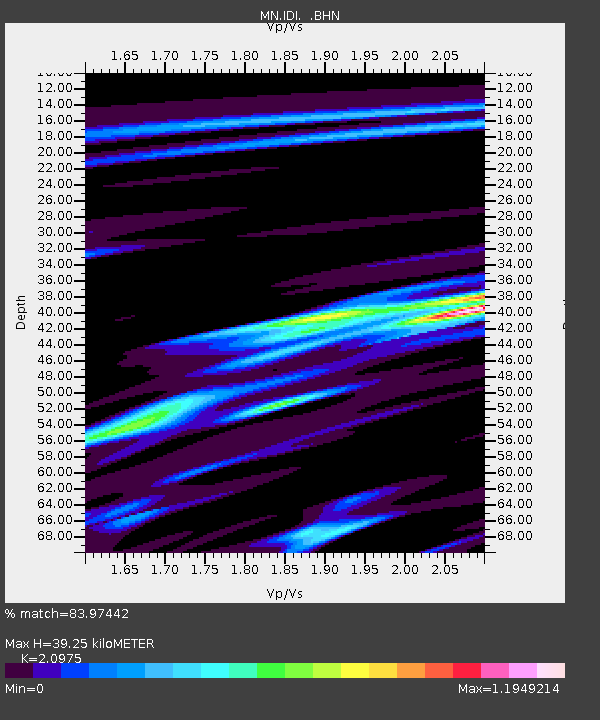
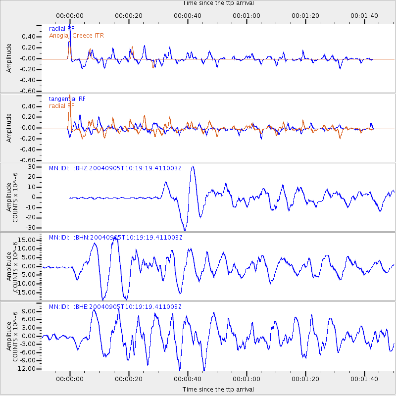
IDI Anogia, Greece - Earthquake Result Viewer

Earthquake location: Near S. Coast Of Western Honshu
Earthquake latitude/longitude: 33.1/136.6
Earthquake time(UTC): 2004/09/05 (249) 10:07:07 GMT
Earthquake Depth: 14 km
Earthquake Magnitude: 6.7 MB, 7.0 MS, 7.2 MW, 7.0 MW
Earthquake Catalog/Contributor: WHDF/NEIC
Network: MN MEDNET Project
Station: IDI Anogia, Greece
Lat/Lon: 35.29 N/24.89 E
Elevation: 750 m
Distance: 86.7 deg
Az: 310.426 deg
Baz: 51.383 deg
Ray Param: 0.04387392
Estimated Moho Depth: 39.25 km
Estimated Crust Vp/Vs: 2.10
Assumed Crust Vp: 5.627 km/s
Estimated Crust Vs: 2.683 km/s
Estimated Crust Poisson's Ratio: 0.35
Radial Match: 83.97442 %
Radial Bump: 400
Transverse Match: 84.15113 %
Transverse Bump: 385
SOD ConfigId: 2459
Insert Time: 2010-03-08 17:08:49.630 +0000
GWidth: 2.5
Max Bumps: 400
Tol: 0.001

Signal To Noise

ChannelStoNSTALTA
MN:IDI: :BHN:20040905T10:19:19.411003Z6.701143.3625108E-65.017819E-7
MN:IDI: :BHE:20040905T10:19:19.411003Z4.9059272.1357955E-64.3535E-7
MN:IDI: :BHZ:20040905T10:19:19.411003Z18.1080957.509982E-64.1473064E-7
Arrivals
Ps7.8 SECOND
PpPs21 SECOND
PsPs/PpSs29 SECOND