IDI Anogia, Greece - Earthquake Result Viewer
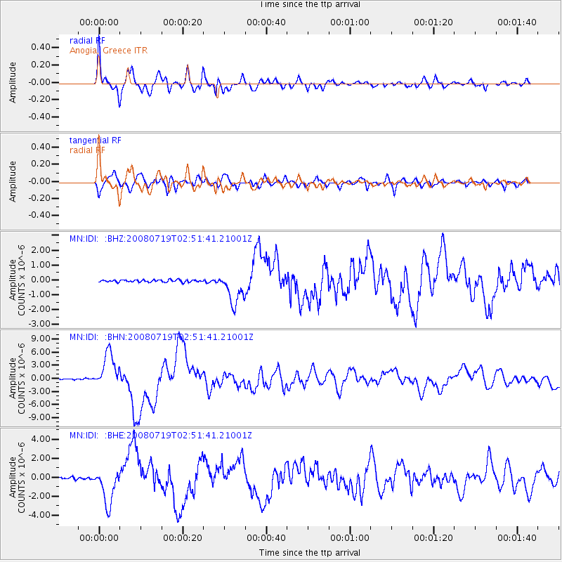
Earthquake location: Off East Coast Of Honshu, Japan
Earthquake latitude/longitude: 37.6/142.2
Earthquake time(UTC): 2008/07/19 (201) 02:39:28 GMT
Earthquake Depth: 22 km
Earthquake Magnitude: 6.2 MB, 7.0 MS, 7.0 MW, 6.9 MW
Earthquake Catalog/Contributor: WHDF/NEIC
Network: MN MEDNET Project
Station: IDI Anogia, Greece
Lat/Lon: 35.29 N/24.89 E
Elevation: 750 m
Distance: 87.1 deg
Az: 313.303 deg
Baz: 44.991 deg
Ray Param: 0.04354633
Estimated Moho Depth: 41.25 km
Estimated Crust Vp/Vs: 1.92
Assumed Crust Vp: 5.627 km/s
Estimated Crust Vs: 2.927 km/s
Estimated Crust Poisson's Ratio: 0.31
Radial Match: 86.282455 %
Radial Bump: 400
Transverse Match: 85.99401 %
Transverse Bump: 400
SOD ConfigId: 2504
Insert Time: 2010-03-08 17:09:10.107 +0000
GWidth: 2.5
Max Bumps: 400
Tol: 0.001

Signal To Noise

ChannelStoNSTALTA
MN:IDI: :BHN:20080719T02:51:41.21001Z42.6031044.1652333E-69.7768314E-8
MN:IDI: :BHE:20080719T02:51:41.21001Z28.723441.955077E-66.806557E-8
MN:IDI: :BHZ:20080719T02:51:41.21001Z15.40278151.1164249E-67.2482024E-8
Arrivals
Ps6.9 SECOND
PpPs21 SECOND
PsPs/PpSs28 SECOND