
IDI Anogia, Greece - Earthquake Result Viewer
| ||||||||||||||||||
| ||||||||||||||||||
| ||||||||||||||||||
|

Signal To Noise
| Channel | StoN | STA | LTA |
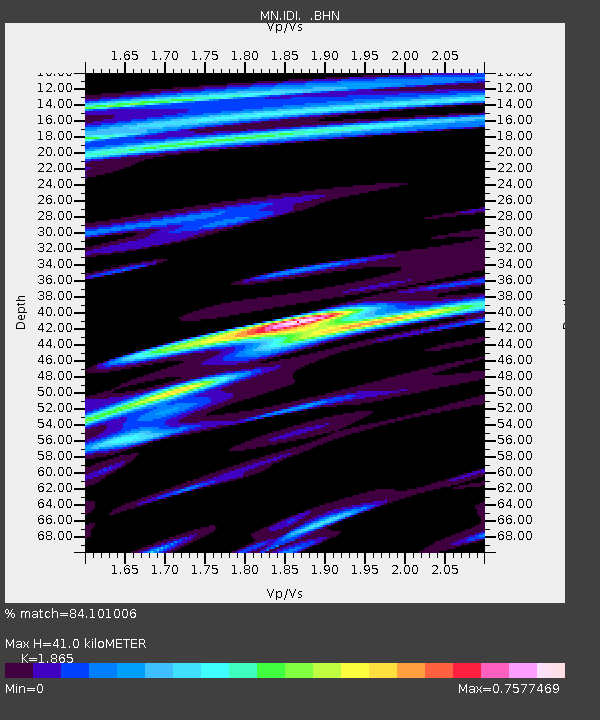
| MN:IDI: :BHN:20080227T07:07:08.911025Z | 3.2491374 | 2.3315793E-7 | 7.175995E-8 |
| MN:IDI: :BHE:20080227T07:07:08.911025Z | 2.868481 | 1.5141184E-7 | 5.2784678E-8 |
| MN:IDI: :BHZ:20080227T07:07:08.911025Z | 5.0149117 | 4.6906487E-7 | 9.353402E-8 |
| Arrivals | |
| Ps | 6.4 SECOND |
| PpPs | 21 SECOND |
| PsPs/PpSs | 27 SECOND |

