
IDI Anogia, Greece - Earthquake Result Viewer
| ||||||||||||||||||
| ||||||||||||||||||
| ||||||||||||||||||
|
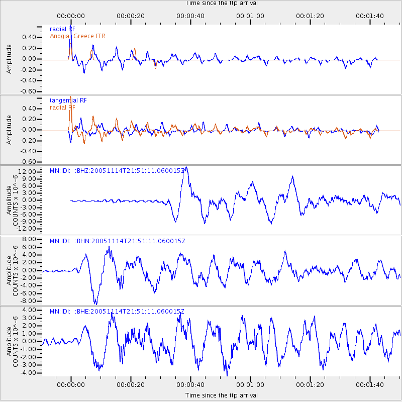
Signal To Noise
| Channel | StoN | STA | LTA |
| MN:IDI: :BHN:20051114T21:51:11.060015Z | 11.63537 | 1.5044862E-6 | 1.2930283E-7 |
| MN:IDI: :BHE:20051114T21:51:11.060015Z | 4.5449743 | 8.2179764E-7 | 1.8081458E-7 |
| MN:IDI: :BHZ:20051114T21:51:11.060015Z | 11.558539 | 2.9995915E-6 | 2.5951303E-7 |
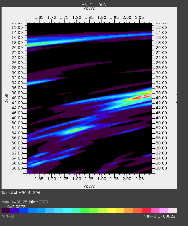
| Arrivals | |
| Ps | 7.6 SECOND |
| PpPs | 21 SECOND |
| PsPs/PpSs | 29 SECOND |

