IDI Anogia, Greece - Earthquake Result Viewer
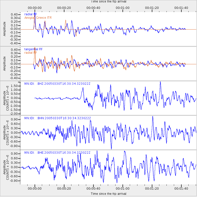
Earthquake location: Off W Coast Of Northern Sumatra
Earthquake latitude/longitude: 3.0/95.4
Earthquake time(UTC): 2005/03/30 (089) 16:19:41 GMT
Earthquake Depth: 22 km
Earthquake Magnitude: 5.9 MB, 6.2 MS, 6.4 MW, 6.3 MW
Earthquake Catalog/Contributor: WHDF/NEIC
Network: MN MEDNET Project
Station: IDI Anogia, Greece
Lat/Lon: 35.29 N/24.89 E
Elevation: 750 m
Distance: 72.4 deg
Az: 305.991 deg
Baz: 98.996 deg
Ray Param: 0.053655133
Estimated Moho Depth: 44.5 km
Estimated Crust Vp/Vs: 1.84
Assumed Crust Vp: 5.627 km/s
Estimated Crust Vs: 3.062 km/s
Estimated Crust Poisson's Ratio: 0.29
Radial Match: 88.05277 %
Radial Bump: 400
Transverse Match: 83.81919 %
Transverse Bump: 400
SOD ConfigId: 2459
Insert Time: 2010-03-08 17:09:30.111 +0000
GWidth: 2.5
Max Bumps: 400
Tol: 0.001

Signal To Noise

ChannelStoNSTALTA
MN:IDI: :BHN:20050330T16:30:34.323022Z1.72298128.769813E-85.0899065E-8
MN:IDI: :BHE:20050330T16:30:34.323022Z2.45674351.6070902E-76.541546E-8
MN:IDI: :BHZ:20050330T16:30:34.323022Z9.8022235.564679E-75.676956E-8
Arrivals
Ps6.8 SECOND
PpPs22 SECOND
PsPs/PpSs29 SECOND