You are here: Home > Network List > CN - Canadian National Seismograph Network Stations List
> Station INK INUVIK, NT > Earthquake Result Viewer
INK INUVIK, NT - Earthquake Result Viewer
*The percent match for this event was below the threshold and hence no stack was calculated.
| Earthquake location: |
Puerto Rico Region |
| Earthquake latitude/longitude: |
17.9/-66.8 |
| Earthquake time(UTC): |
2020/01/07 (007) 08:24:26 GMT |
| Earthquake Depth: |
10 km |
| Earthquake Magnitude: |
6.4 mww |
| Earthquake Catalog/Contributor: |
NEIC PDE/us |
|
| Network: |
CN Canadian National Seismograph Network |
| Station: |
INK INUVIK, NT |
| Lat/Lon: |
68.31 N/133.53 W |
| Elevation: |
44 m |
|
| Distance: |
64.9 deg |
| Az: |
337.85 deg |
| Baz: |
105.086 deg |
| Ray Param: |
$rayparam |
*The percent match for this event was below the threshold and hence was not used in the summary stack. |
|
| Radial Match: |
72.70439 % |
| Radial Bump: |
354 |
| Transverse Match: |
60.960827 % |
| Transverse Bump: |
400 |
| SOD ConfigId: |
20465011 |
| Insert Time: |
2020-01-21 08:35:15.450 +0000 |
| GWidth: |
2.5 |
| Max Bumps: |
400 |
| Tol: |
0.001 |
|
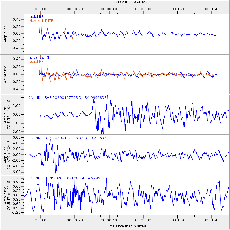
Signal To Noise
| Channel | StoN | STA | LTA |
| CN:INK: :BHZ:20200107T08:34:34.999983Z | 4.434925 | 2.190276E-6 | 4.9386995E-7 |
| CN:INK: :BHN:20200107T08:34:34.999983Z | 2.6098657 | 6.913616E-7 | 2.6490312E-7 |
| CN:INK: :BHE:20200107T08:34:34.999983Z | 4.733586 | 1.0384076E-6 | 2.1937018E-7 |
| Arrivals |
| Ps | |
| PpPs | |
| PsPs/PpSs | |


