IDI Anogia, Greece - Earthquake Result Viewer
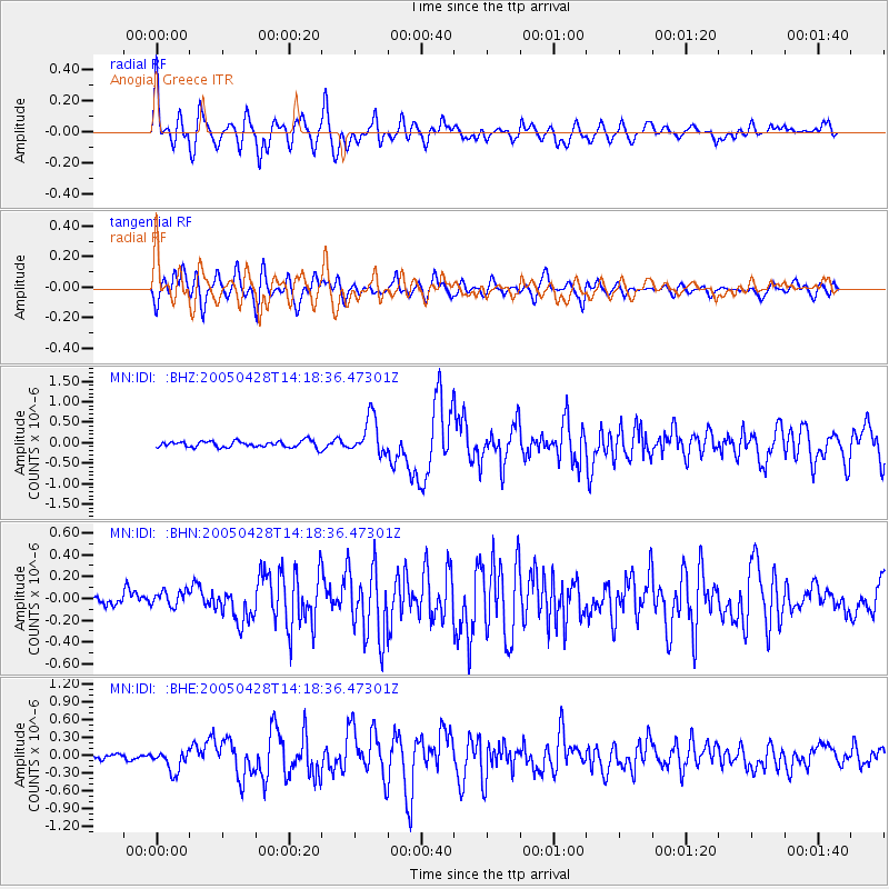
Earthquake location: Northern Sumatra, Indonesia
Earthquake latitude/longitude: 2.1/96.8
Earthquake time(UTC): 2005/04/28 (118) 14:07:33 GMT
Earthquake Depth: 22 km
Earthquake Magnitude: 5.9 MB, 6.2 MS, 6.3 MW, 6.2 MW
Earthquake Catalog/Contributor: WHDF/NEIC
Network: MN MEDNET Project
Station: IDI Anogia, Greece
Lat/Lon: 35.29 N/24.89 E
Elevation: 750 m
Distance: 74.0 deg
Az: 306.016 deg
Baz: 98.869 deg
Ray Param: 0.052583154
Estimated Moho Depth: 45.25 km
Estimated Crust Vp/Vs: 1.82
Assumed Crust Vp: 5.627 km/s
Estimated Crust Vs: 3.1 km/s
Estimated Crust Poisson's Ratio: 0.28
Radial Match: 85.33766 %
Radial Bump: 400
Transverse Match: 83.432 %
Transverse Bump: 400
SOD ConfigId: 2459
Insert Time: 2010-03-08 17:09:35.486 +0000
GWidth: 2.5
Max Bumps: 400
Tol: 0.001

Signal To Noise

ChannelStoNSTALTA
MN:IDI: :BHN:20050428T14:18:36.47301Z1.4361347.511196E-85.23015E-8
MN:IDI: :BHE:20050428T14:18:36.47301Z3.8789411.8426564E-74.750411E-8
MN:IDI: :BHZ:20050428T14:18:36.47301Z5.8619034.5188744E-77.708886E-8
Arrivals
Ps6.7 SECOND
PpPs22 SECOND
PsPs/PpSs29 SECOND